Masuda geodata
Masuda (Shimane) is a seat of a second-order administrative division; located in Japan in Asia/Tokyo (GMT+9) time zone. With population of 48,576 people, there are 384 cities with bigger population in this country. Compared to other cities in Japan, 69.4% of cities are located further ↑North; 83% of cities are located further →East and 66.8% of cities have higher elevation than Masuda. Note1


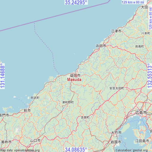
Masuda GPS coordinates[2]
34° 40' 0.012" North, 131° 51' 0" East
| Map corner | latitude | longitude |
|---|---|---|
| Upper-left | 35.24295°, | 131.14688° |
| Center: | 34.66667°, | 131.85° |
| Lower-right: | 34.08635°, | 132.55313° |
| Map W x H: | 128.6×128.6 km | = 79.9×79.9mi |
| max Lat: | 45.40944° ⇑69.4% North |
| Masuda: | 34.66667° |
| min Lat: | ⇓30.6% South 24.34478° |
| min Long | Masuda | max Long |
| 123° | 131.85° | 145.575° |
| W 17%⇐ | ⇒83% E |
Elevation
Elevation of Masuda is 14 m = 46 ft, and this is 70.6 m = 232 ft below average elevation for this country.
| Max E: |
1086 m = 3563 ft | 66.8% |
| Avg. | 84.6 m = 278 ft | |
| Masuda | 14 m = 46 ft | |
Min E: |
-2 m = -7 ft | 33.2% |
See also: Masuda elevation on elevation.city.
Geographical zone
Masuda is located in North temperate zone (between Tropic of Cancer and the Arctic Circle). Distance of this Northern Tropic circle is 1248.7 km =775.9 mi to South.| Distance of | km | miles | from Masuda |
|---|---|---|---|
| North Pole | 6152.5 | 3823 | to North |
| Arctic Circle | 3546.6 | 2203.8 | to North |
| Tropic Cancer | 1248.7 | 775.9 | to South |
| Equator | 3854.6 | 2395.1 | to South |


Nearby cities:
15 places around Masuda: (largest is in red/bold)
• Gōtsuchō
51.2 km =31.8 mi,  42°
42°
• Hagi
49.5 km =30.8 mi,  233°
233°
• Hamada
32.2 km =20 mi, 41°
• Hatsukaichi
56.6 km =35.2 mi,  128°
128°
• Hiroshima
62.4 km =38.8 mi,  118°
118°
• Hōfu
73.3 km =45.5 mi,  200°
200°
• Iwakuni
65.5 km =40.7 mi,  148°
148°
• Kudamatsu
74.1 km =46 mi,  178°
178°
• Miyajima
59.5 km =37 mi, 133°
• Nagato
67.4 km =41.9 mi,  242°
242°
• Shūnan
65.2 km =40.5 mi, 181°
• Tokuyama
68.6 km =42.6 mi, 182°
• Yamaguchi
64.2 km =39.9 mi,  213°
213°
• Ōno-hara
57.2 km =35.5 mi,  138°
138°
• Ōtake
61.3 km =38.1 mi, 146°
Sources, notices
• [Note1] Compared only with cities in Japan existing in our database
• [Src1] Map data: © OpenStreetMap contributors (CC-BY-SA)
• [Src2] Other city data from geonames.org with taken over terms of usage.
• [Src3] Geographical zone / Annual Mean Temperature by Robert A. Rohde @ Wikipedia
