Hagi geodata
Hagi (Yamaguchi) is a seat of a second-order administrative division; located in Japan in Asia/Tokyo (GMT+9) time zone. With population of 43,826 people, there are 415 cities with bigger population in this country. Compared to other cities in Japan, 74.4% of cities are located further ↑North; 84.7% of cities are located further →East and 52.4% of cities have lower elevation than Hagi. Note1


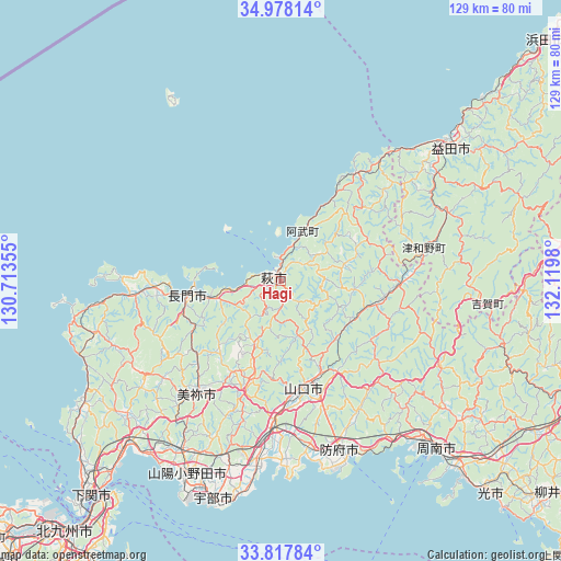
Hagi GPS coordinates[2]
34° 24' 0" North, 131° 25' 0.012" East
| Map corner | latitude | longitude |
|---|---|---|
| Upper-left | 34.97814°, | 130.71355° |
| Center: | 34.4°, | 131.41667° |
| Lower-right: | 33.81784°, | 132.1198° |
| Map W x H: | 129×129 km | = 80.2×80.2mi |
| max Lat: | 45.40944° ⇑74.4% North |
| Hagi: | 34.4° |
| min Lat: | ⇓25.6% South 24.34478° |
| min Long | Hagi | max Long |
| 123° | 131.41667° | 145.575° |
| W 15.3%⇐ | ⇒84.7% E |
Elevation
Elevation of Hagi is 31 m = 102 ft, and this is 53.6 m = 176 ft below average elevation for this country.
| Max E: |
1086 m = 3563 ft | 47.6% |
| Avg. | 84.6 m = 278 ft | |
| Hagi | 31 m = 102 ft | |
Min E: |
-2 m = -7 ft | 52.4% |
See also: Hagi elevation on elevation.city.
Geographical zone
Hagi is located in North temperate zone (between Tropic of Cancer and the Arctic Circle). Distance of this Northern Tropic circle is 1219 km =757.5 mi to South.| Distance of | km | miles | from Hagi |
|---|---|---|---|
| North Pole | 6182.1 | 3841.4 | to North |
| Arctic Circle | 3576.3 | 2222.2 | to North |
| Tropic Cancer | 1219 | 757.5 | to South |
| Equator | 3824.9 | 2376.7 | to South |


Nearby cities:
15 places around Hagi: (largest is in red/bold)
• Hikari
69.7 km =43.3 mi,  135°
135°
• Hōfu
41.3 km =25.7 mi,  160°
160°
• Kudamatsu
60.8 km =37.8 mi, 137°
• Masuda
49.5 km =30.8 mi,  53°
53°
• Mine
30 km =18.6 mi,  217°
217°
• Nagato
20 km =12.4 mi,  264°
264°
• Ogōri-shimogō
33.4 km =20.8 mi,  182°
182°
• Onoda
49.2 km =30.6 mi,  205°
205°
• Sanyōonoda
47.2 km =29.3 mi, 209°
• Shimonoseki
46.2 km =28.7 mi,  235°
235°
• Shimonoseki
65.9 km =40.9 mi, 220°
• Shūnan
51.7 km =32.1 mi,  133°
133°
• Tokuyama
53.5 km =33.2 mi, 136°
• Ube
53 km =32.9 mi,  196°
196°
• Yamaguchi
24.5 km =15.2 mi,  169°
169°
Sources, notices
• [Note1] Compared only with cities in Japan existing in our database
• [Src1] Map data: © OpenStreetMap contributors (CC-BY-SA)
• [Src2] Other city data from geonames.org with taken over terms of usage.
• [Src3] Geographical zone / Annual Mean Temperature by Robert A. Rohde @ Wikipedia
