Hitoyoshi geodata
Hitoyoshi (Kumamoto) is a seat of a second-order administrative division; located in Japan in Asia/Tokyo (GMT+9) time zone. With population of 38,006 people, there are 474 cities with bigger population in this country. Compared to other cities in Japan, 94.1% of cities are located further ↑North; 88.7% of cities are located further →East and 81.3% of cities have lower elevation than Hitoyoshi. Note1


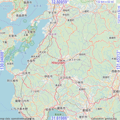
Hitoyoshi GPS coordinates[2]
32° 13' 0.012" North, 130° 45' 0" East
| Map corner | latitude | longitude |
|---|---|---|
| Upper-left | 32.80959°, | 130.04688° |
| Center: | 32.21667°, | 130.75° |
| Lower-right: | 31.61986°, | 131.45313° |
| Map W x H: | 132.3×132.3 km | = 82.2×82.2mi |
| max Lat: | 45.40944° ⇑94.1% North |
| Hitoyoshi: | 32.21667° |
| min Lat: | ⇓5.9% South 24.34478° |
| min Long | Hitoyoshi | max Long |
| 123° | 130.75° | 145.575° |
| W 11.3%⇐ | ⇒88.7% E |
Elevation
Elevation of Hitoyoshi is 130 m = 427 ft, and this is 45.4 m = 149 ft above average elevation for this country.
| Max E: |
1086 m = 3563 ft | 18.7% |
| Hitoyoshi | 130 m 427 ft | |
| Avg. | 84.6 m = 278 ft | |
Min E: |
-2 m = -7 ft | 81.3% |
See also: Japan elevation on elevation.city.
Geographical zone
Hitoyoshi is located in North temperate zone (between Tropic of Cancer and the Arctic Circle). Distance of this Northern Tropic circle is 976.2 km =606.6 mi to South.| Distance of | km | miles | from Hitoyoshi |
|---|---|---|---|
| North Pole | 6424.9 | 3992.2 | to North |
| Arctic Circle | 3819 | 2373 | to North |
| Tropic Cancer | 976.2 | 606.6 | to South |
| Equator | 3582.2 | 2225.9 | to South |


Nearby cities:
15 places around Hitoyoshi: (largest is in red/bold)
• Aira
51.4 km =31.9 mi,  196°
196°
• Ebino
20.8 km =12.9 mi,  154°
154°
• Honmachi
35 km =21.7 mi,  336°
336°
• Isa
21.1 km =13.1 mi,  218°
218°
• Izumi
39 km =24.2 mi,  247°
247°
• Kamiamakusa
45.1 km =28 mi,  312°
312°
• Kirishima
52.9 km =32.9 mi,  178°
178°
• Kobayashi
34 km =21.1 mi,  139°
139°
• Matsubase
48.8 km =30.3 mi,  350°
350°
• Minamata
32.9 km =20.4 mi,  270°
270°
• Uki
45.8 km =28.5 mi, 349°
• Uto
52.5 km =32.6 mi, 351°
• Yatsushiro
38.9 km =24.2 mi, 346°
• Yotsueda
22.5 km =14 mi, 183°
• Ōkuchi-shinohara
20.3 km =12.6 mi, 215°
Sources, notices
• [Note1] Compared only with cities in Japan existing in our database
• [Src1] Map data: © OpenStreetMap contributors (CC-BY-SA)
• [Src2] Other city data from geonames.org with taken over terms of usage.
• [Src3] Geographical zone / Annual Mean Temperature by Robert A. Rohde @ Wikipedia
