Morioka geodata
Morioka (Iwate) is a seat of a first-order administrative division; located in Japan in Asia/Tokyo (GMT+9) time zone. With population of 295,172 people, there are 69 cities with bigger population in this country. Compared to other cities in Japan, 92.5% of cities are located further ↓South; 93.9% of cities are located further ←West and 81.8% of cities have lower elevation than Morioka. Note1


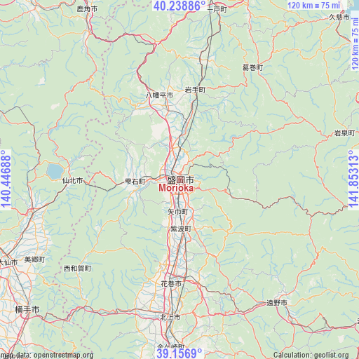
Morioka GPS coordinates[2]
39° 42' 0" North, 141° 9' 0" East
| Map corner | latitude | longitude |
|---|---|---|
| Upper-left | 40.23886°, | 140.44688° |
| Center: | 39.7°, | 141.15° |
| Lower-right: | 39.1569°, | 141.85313° |
| Map W x H: | 120.3×120.3 km | = 74.8×74.8mi |
| max Lat: | 45.40944° ⇑7.5% North |
| Morioka: | 39.7° |
| min Lat: | ⇓92.5% South 24.34478° |
| min Long | Morioka | max Long |
| 123° | 141.15° | 145.575° |
| W 93.9%⇐ | ⇒6.1% E |
Elevation
Elevation of Morioka is 138 m = 453 ft, and this is 53.4 m = 175 ft above average elevation for this country.
| Max E: |
1086 m = 3563 ft | 18.2% |
| Morioka | 138 m 453 ft | |
| Avg. | 84.6 m = 278 ft | |
Min E: |
-2 m = -7 ft | 81.8% |
See also: Morioka elevation on elevation.city.
Geographical zone
Morioka is located in North temperate zone (between Tropic of Cancer and the Arctic Circle). Distance of this Northern Tropic circle is 1808.3 km =1123.6 mi to South.| Distance of | km | miles | from Morioka |
|---|---|---|---|
| North Pole | 5592.8 | 3475.2 | to North |
| Arctic Circle | 2986.9 | 1856 | to North |
| Tropic Cancer | 1808.3 | 1123.6 | to South |
| Equator | 4414.2 | 2742.9 | to South |


Nearby cities:
15 places around Morioka: (largest is in red/bold)
• Daisen
63.5 km =39.5 mi,  243°
243°
• Hachimantai
22.3 km =13.9 mi,  355°
355°
• Hanamaki
35.3 km =21.9 mi,  184°
184°
• Hanawa
62 km =38.5 mi,  330°
330°
• Ichinohe
59 km =36.7 mi,  11°
11°
• Kakunodatemachi
51.4 km =31.9 mi,  256°
256°
• Kazuno
64.6 km =40.1 mi, 331°
• Kitakami
46.4 km =28.8 mi, 183°
• Mizusawa
63 km =39.1 mi, 181°
• Semboku
34.5 km =21.4 mi,  271°
271°
• Shizukuishi
14.2 km =8.8 mi, 267°
• Takizawa
11.5 km =7.1 mi,  353°
353°
• Tōno
53.8 km =33.4 mi,  142°
142°
• Ōmagari
63.5 km =39.5 mi, 244°
• Ōshū
62.4 km =38.8 mi, 178°
Sources, notices
• [Note1] Compared only with cities in Japan existing in our database
• [Src1] Map data: © OpenStreetMap contributors (CC-BY-SA)
• [Src2] Other city data from geonames.org with taken over terms of usage.
• [Src3] Geographical zone / Annual Mean Temperature by Robert A. Rohde @ Wikipedia
