Semboku geodata
Semboku (Akita) is a seat of a second-order administrative division; located in Japan in Asia/Tokyo (GMT+9) time zone. In our database, there are 767 cities with bigger population. Compared to other cities in Japan, 92.6% of cities are located further ↓South; 90.6% of cities are located further ←West and 95.9% of cities have lower elevation than Semboku. Note1


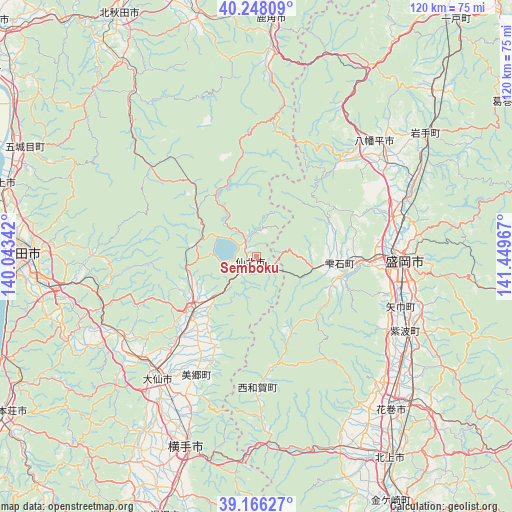
Semboku GPS coordinates[2]
39° 42' 33.48" North, 140° 44' 47.544" East
| Map corner | latitude | longitude |
|---|---|---|
| Upper-left | 40.24809°, | 140.04342° |
| Center: | 39.7093°, | 140.74654° |
| Lower-right: | 39.16627°, | 141.44967° |
| Map W x H: | 120.3×120.3 km | = 74.8×74.8mi |
| max Lat: | 45.40944° ⇑7.4% North |
| Semboku: | 39.7093° |
| min Lat: | ⇓92.6% South 24.34478° |
| min Long | Semboku | max Long |
| 123° | 140.74654° | 145.575° |
| W 90.6%⇐ | ⇒9.4% E |
Elevation
Elevation of Semboku is 389 m = 1276 ft, and this is 304.4 m = 999 ft above average elevation for this country.
| Max E: |
1086 m = 3563 ft | 4.1% |
| Semboku | 389 m 1276 ft | |
| Avg. | 84.6 m = 278 ft | |
Min E: |
-2 m = -7 ft | 95.9% |
See also: Japan elevation on elevation.city.
Geographical zone
Semboku is located in North temperate zone (between Tropic of Cancer and the Arctic Circle). Distance of this Northern Tropic circle is 1809.3 km =1124.2 mi to South.| Distance of | km | miles | from Semboku |
|---|---|---|---|
| North Pole | 5591.8 | 3474.6 | to North |
| Arctic Circle | 2985.9 | 1855.4 | to North |
| Tropic Cancer | 1809.3 | 1124.2 | to South |
| Equator | 4415.3 | 2743.5 | to South |


Nearby cities:
15 places around Semboku: (largest is in red/bold)
• Akita
53.9 km =33.5 mi,  270°
270°
• Daisen
37.1 km =23.1 mi,  216°
216°
• Hachimantai
39 km =24.2 mi,  57°
57°
• Hanamaki
48.2 km =30 mi,  138°
138°
• Hanawa
52.9 km =32.9 mi,  3°
3°
• Kakunodatemachi
20.3 km =12.6 mi,  228°
228°
• Kazuno
55.6 km =34.5 mi, 3°
• Kita-Akita
62.2 km =38.6 mi,  331°
331°
• Kitakami
57 km =35.4 mi,  146°
146°
• Morioka
34.5 km =21.4 mi,  91°
91°
• Shizukuishi
20.4 km =12.7 mi, 94°
• Takizawa
34.8 km =21.6 mi,  72°
72°
• Yokote
46.8 km =29.1 mi,  201°
201°
• Yuzawa
63.9 km =39.7 mi, 199°
• Ōmagari
36.6 km =22.7 mi, 218°
Sources, notices
• [Note1] Compared only with cities in Japan existing in our database
• [Src1] Map data: © OpenStreetMap contributors (CC-BY-SA)
• [Src2] Other city data from geonames.org with taken over terms of usage.
• [Src3] Geographical zone / Annual Mean Temperature by Robert A. Rohde @ Wikipedia
