Shimokizukuri geodata
Shimokizukuri (Aomori) is a populated place; located in Japan in Asia/Tokyo (GMT+9) time zone. With population of 18,907 people, there are 711 cities with bigger population in this country. Compared to other cities in Japan, 95.1% of cities are located further ↓South; 84.4% of cities are located further ←West and 95.3% of cities have higher elevation than Shimokizukuri. Note1


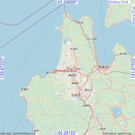
Shimokizukuri GPS coordinates[2]
40° 48' 57.924" North, 140° 22' 31.404" East
| Map corner | latitude | longitude |
|---|---|---|
| Upper-left | 41.34609°, | 139.67227° |
| Center: | 40.81609°, | 140.37539° |
| Lower-right: | 40.28182°, | 141.07852° |
| Map W x H: | 118.3×118.3 km | = 73.5×73.5mi |
| max Lat: | 45.40944° ⇑4.9% North |
| Shimokizukuri: | 40.81609° |
| min Lat: | ⇓95.1% South 24.34478° |
| min Long | Shimokizukuri | max Long |
| 123° | 140.37539° | 145.575° |
| W 84.4%⇐ | ⇒15.6% E |
Elevation
Elevation of Shimokizukuri is 3 m = 10 ft, and this is 81.6 m = 268 ft below average elevation for this country.
| Max E: |
1086 m = 3563 ft | 95.3% |
| Avg. | 84.6 m = 278 ft | |
| Shimokizukuri | 3 m = 10 ft | |
Min E: |
-2 m = -7 ft | 4.7% |
See also: Japan elevation on elevation.city.
Geographical zone
Shimokizukuri is located in North temperate zone (between Tropic of Cancer and the Arctic Circle). Distance of this Northern Tropic circle is 1932.4 km =1200.7 mi to South.| Distance of | km | miles | from Shimokizukuri |
|---|---|---|---|
| North Pole | 5468.7 | 3398.1 | to North |
| Arctic Circle | 2862.9 | 1778.9 | to North |
| Tropic Cancer | 1932.4 | 1200.7 | to South |
| Equator | 4538.3 | 2820 | to South |


Nearby cities:
15 places around Shimokizukuri: (largest is in red/bold)
• Aomori
30.1 km =18.7 mi,  89°
89°
• Goshogawara
5.7 km =3.5 mi,  103°
103°
• Hanawa
78.5 km =48.8 mi,  153°
153°
• Hirakawa
30.3 km =18.8 mi, 147°
• Hirosaki
26.1 km =16.2 mi,  161°
161°
• Kazuno
75.9 km =47.2 mi, 152°
• Kita-Akita
68.6 km =42.6 mi,  178°
178°
• Kuroishi
25.8 km =16 mi,  137°
137°
• Kuroishi
35.5 km =22.1 mi,  128°
128°
• Namioka
21.6 km =13.4 mi,  122°
122°
• Noshiro
73.7 km =45.8 mi,  203°
203°
• Takanosu
66 km =41 mi, 180°
• Towada
73.7 km =45.8 mi,  107°
107°
• Tsugaru
2.7 km =1.7 mi, 120°
• Ōdate
62.4 km =38.8 mi,  165°
165°
Sources, notices
• [Note1] Compared only with cities in Japan existing in our database
• [Src1] Map data: © OpenStreetMap contributors (CC-BY-SA)
• [Src2] Other city data from geonames.org with taken over terms of usage.
• [Src3] Geographical zone / Annual Mean Temperature by Robert A. Rohde @ Wikipedia
