Tosa geodata
Tosa (Kochi) is a seat of a second-order administrative division; located in Japan in Asia/Tokyo (GMT+9) time zone. In our database, there are 767 cities with bigger population. Compared to other cities in Japan, 85.5% of cities are located further ↑North; 77.7% of cities are located further →East and 68.3% of cities have higher elevation than Tosa. Note1


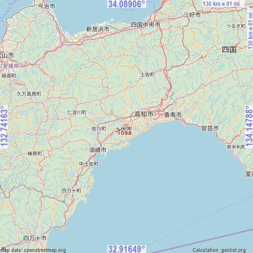
Tosa GPS coordinates[2]
33° 30' 17.136" North, 133° 26' 41.1" East
| Map corner | latitude | longitude |
|---|---|---|
| Upper-left | 34.08906°, | 132.74163° |
| Center: | 33.50476°, | 133.44475° |
| Lower-right: | 32.91649°, | 134.14788° |
| Map W x H: | 130.4×130.4 km | = 81×81mi |
| max Lat: | 45.40944° ⇑85.5% North |
| Tosa: | 33.50476° |
| min Lat: | ⇓14.5% South 24.34478° |
| min Long | Tosa | max Long |
| 123° | 133.44475° | 145.575° |
| W 22.3%⇐ | ⇒77.7% E |
Elevation
Elevation of Tosa is 13 m = 43 ft, and this is 71.6 m = 235 ft below average elevation for this country.
| Max E: |
1086 m = 3563 ft | 68.3% |
| Avg. | 84.6 m = 278 ft | |
| Tosa | 13 m = 43 ft | |
Min E: |
-2 m = -7 ft | 31.7% |
See also: Japan elevation on elevation.city.
Geographical zone
Tosa is located in North temperate zone (between Tropic of Cancer and the Arctic Circle). Distance of this Northern Tropic circle is 1119.5 km =695.6 mi to South.| Distance of | km | miles | from Tosa |
|---|---|---|---|
| North Pole | 6281.7 | 3903.3 | to North |
| Arctic Circle | 3675.8 | 2284 | to North |
| Tropic Cancer | 1119.5 | 695.6 | to South |
| Equator | 3725.4 | 2314.9 | to South |


Nearby cities:
15 places around Tosa: (largest is in red/bold)
• Aki
42.2 km =26.2 mi,  90°
90°
• Ikedachō
67.1 km =41.7 mi,  29°
29°
• Ino
5.1 km =3.2 mi,  348°
348°
• Kami
42 km =26.1 mi,  61°
61°
• Kan’onji
65.6 km =40.8 mi,  16°
16°
• Kawanoechō
58.2 km =36.2 mi,  12°
12°
• Kochi
9.6 km =6 mi, 58°
• Kōnan
32.4 km =20.1 mi,  74°
74°
• Miyoshi
60.3 km =37.5 mi,  39°
39°
• Nankoku
20.3 km =12.6 mi, 69°
• Niihama
52.3 km =32.5 mi, 345°
• Saijō
51.8 km =32.2 mi,  332°
332°
• Shikokuchūō
53.2 km =33.1 mi, 10°
• Susaki
18.8 km =11.7 mi,  229°
229°
• Tōon
60.6 km =37.7 mi,  302°
302°
Sources, notices
• [Note1] Compared only with cities in Japan existing in our database
• [Src1] Map data: © OpenStreetMap contributors (CC-BY-SA)
• [Src2] Other city data from geonames.org with taken over terms of usage.
• [Src3] Geographical zone / Annual Mean Temperature by Robert A. Rohde @ Wikipedia
