Narashino geodata
Narashino (Chiba) is a seat of a second-order administrative division; located in Japan in Asia/Tokyo (GMT+9) time zone. In our database, there are 767 cities with bigger population. Compared to other cities in Japan, 57.3% of cities are located further ↓South; 79.5% of cities are located further ←West and 63.7% of cities have higher elevation than Narashino. Note1


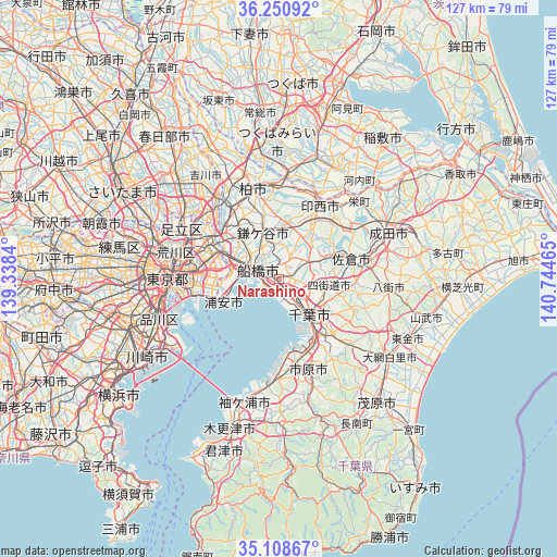
Narashino GPS coordinates[2]
35° 40' 54.624" North, 140° 2' 29.472" East
| Map corner | latitude | longitude |
|---|---|---|
| Upper-left | 36.25092°, | 139.3384° |
| Center: | 35.68184°, | 140.04152° |
| Lower-right: | 35.10867°, | 140.74465° |
| Map W x H: | 127×127 km | = 78.9×78.9mi |
| max Lat: | 45.40944° ⇑42.7% North |
| Narashino: | 35.68184° |
| min Lat: | ⇓57.3% South 24.34478° |
| min Long | Narashino | max Long |
| 123° | 140.04152° | 145.575° |
| W 79.5%⇐ | ⇒20.5% E |
Elevation
Elevation of Narashino is 16 m = 52 ft, and this is 68.6 m = 225 ft below average elevation for this country.
| Max E: |
1086 m = 3563 ft | 63.7% |
| Avg. | 84.6 m = 278 ft | |
| Narashino | 16 m = 52 ft | |
Min E: |
-2 m = -7 ft | 36.3% |
See also: Japan elevation on elevation.city.
Geographical zone
Narashino is located in North temperate zone (between Tropic of Cancer and the Arctic Circle). Distance of this Northern Tropic circle is 1361.5 km =846 mi to South.| Distance of | km | miles | from Narashino |
|---|---|---|---|
| North Pole | 6039.6 | 3752.8 | to North |
| Arctic Circle | 3433.7 | 2133.6 | to North |
| Tropic Cancer | 1361.5 | 846 | to South |
| Equator | 3967.4 | 2465.2 | to South |


Nearby cities:
15 places around Narashino: (largest is in red/bold)
• Chiba
11.4 km =7.1 mi,  143°
143°
• Funabashi
5.1 km =3.2 mi,  327°
327°
• Honchō
5.4 km =3.4 mi,  293°
293°
• Ichihara
18.8 km =11.7 mi,  168°
168°
• Ichikawa-minami
13.4 km =8.3 mi, 291°
• Inzai
20.3 km =12.6 mi,  32°
32°
• Kamagaya
10.4 km =6.5 mi,  340°
340°
• Matsudo
16.7 km =10.4 mi,  310°
310°
• Sakura
17.7 km =11 mi,  77°
77°
• Shiroi
13.3 km =8.3 mi,  9°
9°
• Shisui
20.7 km =12.9 mi, 79°
• Urayasu
13.2 km =8.2 mi,  250°
250°
• Urayasu
13.9 km =8.6 mi,  264°
264°
• Yachiyo
9.6 km =6 mi,  51°
51°
• Yotsukaidō
11.8 km =7.3 mi,  107°
107°
Sources, notices
• [Note1] Compared only with cities in Japan existing in our database
• [Src1] Map data: © OpenStreetMap contributors (CC-BY-SA)
• [Src2] Other city data from geonames.org with taken over terms of usage.
• [Src3] Geographical zone / Annual Mean Temperature by Robert A. Rohde @ Wikipedia
