Panghyŏn-dong geodata
Panghyŏn-dong (P'yŏngan-bukto) is a populated place; located in North Korea in Asia/Pyongyang (GMT+9) time zone. With population of 11,026 people, there are 72 cities with bigger population in this country. Compared to other cities in North Korea, 56% of cities are located further ↑North; 92.3% of cities are located further →East and 62.6% of cities have lower elevation than Panghyŏn-dong. Note1


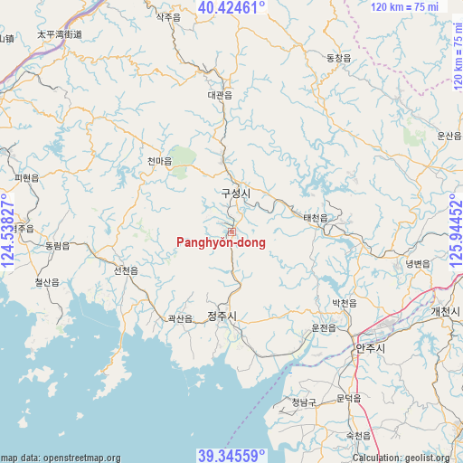
Panghyŏn-dong GPS coordinates[2]
39° 53' 13.992" North, 125° 14' 29.004" East
| Map corner | latitude | longitude |
|---|---|---|
| Upper-left | 40.42461°, | 124.53827° |
| Center: | 39.88722°, | 125.24139° |
| Lower-right: | 39.34559°, | 125.94452° |
| Map W x H: | 120×120 km | = 74.6×74.6mi |
| max Lat: | 42.95722° ⇑56% North |
| Panghyŏn-dong: | 39.88722° |
| min Lat: | ⇓44% South 37.90889° |
| min Long | Panghyŏn-dong | max Long |
| 124.39806° | 125.24139° | 130.49522° |
| W 7.7%⇐ | ⇒92.3% E |
Elevation
Elevation of Panghyŏn-dong is 81 m = 266 ft, and this is 50.7 m = 166 ft below average elevation for this country.
| Max E: |
1466 m = 4810 ft | 37.4% |
| Avg. | 131.7 m = 432 ft | |
| Panghyŏn-dong | 81 m = 266 ft | |
Min E: |
1 m = 3 ft | 62.6% |
See also: North Korea elevation on elevation.city.
Geographical zone
Panghyŏn-dong is located in North temperate zone (between Tropic of Cancer and the Arctic Circle). Distance of this Northern Tropic circle is 1829.1 km =1136.5 mi to South.| Distance of | km | miles | from Panghyŏn-dong |
|---|---|---|---|
| North Pole | 5572 | 3462.3 | to North |
| Arctic Circle | 2966.1 | 1843 | to North |
| Tropic Cancer | 1829.1 | 1136.5 | to South |
| Equator | 4435 | 2755.8 | to South |


Nearby cities:
15 places around Panghyŏn-dong: (largest is in red/bold)
• Anju
47 km =29.2 mi,  129°
129°
• Chŏngju
21.7 km =13.5 mi,  187°
187°
• Kujang-ŭp
67.4 km =41.9 mi,  91°
91°
• Kusŏng
10.4 km =6.5 mi,  1°
1°
• Kwaksan
26 km =16.2 mi,  211°
211°
• Pukchil-lodongjagu
55.6 km =34.5 mi,  50°
50°
• Sakchu-ŭp
58.2 km =36.2 mi,  343°
343°
• Sil-li
48 km =29.8 mi,  155°
155°
• Sinanju
45 km =28 mi,  135°
135°
• Sinŭiju
75.7 km =47 mi,  288°
288°
• Sunan
85.7 km =53.3 mi,  153°
153°
• Sunch’ŏn
77.9 km =48.4 mi, 130°
• Yŏmju-ŭp
54.9 km =34.1 mi,  270°
270°
• Yŏngbyŏn
48.7 km =30.3 mi,  99°
99°
• Ŭiju
69.7 km =43.3 mi,  299°
299°
Sources, notices
• [Note1] Compared only with cities in North Korea existing in our database
• [Src1] Map data: © OpenStreetMap contributors (CC-BY-SA)
• [Src2] Other city data from geonames.org with taken over terms of usage.
• [Src3] Geographical zone / Annual Mean Temperature by Robert A. Rohde @ Wikipedia
