Hamhŭng geodata
Hamhŭng (Hamgyŏng-namdo) is a seat of a first-order administrative division; located in North Korea in Asia/Pyongyang (GMT+9) time zone. With population of 559,056 people, there is 1 city with bigger population in this country. Compared to other cities in North Korea, 53.8% of cities are located further ↑North; 54.9% of cities are located further ←West and 79.1% of cities have higher elevation than Hamhŭng. Note1


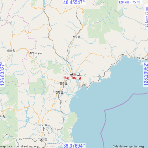
Hamhŭng GPS coordinates[2]
39° 55' 5.988" North, 127° 32' 11.004" East
| Map corner | latitude | longitude |
|---|---|---|
| Upper-left | 40.45547°, | 126.83327° |
| Center: | 39.91833°, | 127.53639° |
| Lower-right: | 39.37694°, | 128.23952° |
| Map W x H: | 119.9×119.9 km | = 74.5×74.5mi |
| max Lat: | 42.95722° ⇑53.8% North |
| Hamhŭng: | 39.91833° |
| min Lat: | ⇓46.2% South 37.90889° |
| min Long | Hamhŭng | max Long |
| 124.39806° | 127.53639° | 130.49522° |
| W 54.9%⇐ | ⇒45.1% E |
Elevation
Elevation of Hamhŭng is 16 m = 52 ft, and this is 115.7 m = 380 ft below average elevation for this country.
| Max E: |
1466 m = 4810 ft | 79.1% |
| Avg. | 131.7 m = 432 ft | |
| Hamhŭng | 16 m = 52 ft | |
Min E: |
1 m = 3 ft | 20.9% |
See also: Hamhŭng elevation on elevation.city.
Geographical zone
Hamhŭng is located in North temperate zone (between Tropic of Cancer and the Arctic Circle). Distance of this Northern Tropic circle is 1832.6 km =1138.7 mi to South.| Distance of | km | miles | from Hamhŭng |
|---|---|---|---|
| North Pole | 5568.6 | 3460.2 | to North |
| Arctic Circle | 2962.7 | 1840.9 | to North |
| Tropic Cancer | 1832.6 | 1138.7 | to South |
| Equator | 4438.5 | 2758 | to South |


Nearby cities:
15 places around Hamhŭng: (largest is in red/bold)
• Anbyŏn-ŭp
97.4 km =60.5 mi,  180°
180°
• Hoeyang
134.4 km =83.5 mi, 177°
• Hongwŏn
37.7 km =23.4 mi,  71°
71°
• Hŭngnam
11.9 km =7.4 mi,  143°
143°
• Iwŏn-ŭp
105.2 km =65.4 mi,  64°
64°
• Kosan
118.6 km =73.7 mi, 184°
• Kowŏn-ŭp
59 km =36.7 mi,  205°
205°
• Kujang-ŭp
128.6 km =79.9 mi,  267°
267°
• Samho-rodongjagu
28.7 km =17.8 mi,  83°
83°
• Sangsŏng-ni
100.2 km =62.3 mi, 213°
• Sinsang-ni
31.8 km =19.8 mi,  200°
200°
• T’ongch’ŏn-ŭp
111.5 km =69.3 mi,  164°
164°
• Wŏnsan
85.5 km =53.1 mi,  185°
185°
• Yuktae-dong
54.4 km =33.8 mi, 77°
• Yŏnggwang-ŭp
13.1 km =8.1 mi,  327°
327°
Sources, notices
• [Note1] Compared only with cities in North Korea existing in our database
• [Src1] Map data: © OpenStreetMap contributors (CC-BY-SA)
• [Src2] Other city data from geonames.org with taken over terms of usage.
• [Src3] Geographical zone / Annual Mean Temperature by Robert A. Rohde @ Wikipedia
