Samho-rodongjagu geodata
Samho-rodongjagu (Hamgyŏng-namdo) is a populated place; located in North Korea in Asia/Pyongyang (GMT+9) time zone. With population of 19,025 people, there are 54 cities with bigger population in this country. Compared to other cities in North Korea, 52.7% of cities are located further ↑North; 58.2% of cities are located further ←West and 95.6% of cities have higher elevation than Samho-rodongjagu. Note1


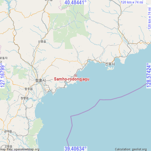
Samho-rodongjagu GPS coordinates[2]
39° 56' 51" North, 127° 52' 15.996" East
| Map corner | latitude | longitude |
|---|---|---|
| Upper-left | 40.48441°, | 127.16799° |
| Center: | 39.9475°, | 127.87111° |
| Lower-right: | 39.40634°, | 128.57424° |
| Map W x H: | 119.9×119.9 km | = 74.5×74.5mi |
| max Lat: | 42.95722° ⇑52.7% North |
| Samho-rodongjagu: | 39.9475° |
| min Lat: | ⇓47.3% South 37.90889° |
| min Long | Samho-rodongjag | max Long |
| 124.39806° | 127.87111° | 130.49522° |
| W 58.2%⇐ | ⇒41.8% E |
Elevation
Elevation of Samho-rodongjagu is 4 m = 13 ft, and this is 127.7 m = 419 ft below average elevation for this country.
| Max E: |
1466 m = 4810 ft | 95.6% |
| Avg. | 131.7 m = 432 ft | |
| Samho-rodongjagu | 4 m = 13 ft | |
Min E: |
1 m = 3 ft | 4.4% |
See also: North Korea elevation on elevation.city.
Geographical zone
Samho-rodongjagu is located in North temperate zone (between Tropic of Cancer and the Arctic Circle). Distance of this Northern Tropic circle is 1835.8 km =1140.7 mi to South.| Distance of | km | miles | from Samho-rodongjagu |
|---|---|---|---|
| North Pole | 5565.3 | 3458.1 | to North |
| Arctic Circle | 2959.4 | 1838.9 | to North |
| Tropic Cancer | 1835.8 | 1140.7 | to South |
| Equator | 4441.7 | 2759.9 | to South |


Nearby cities:
15 places around Samho-rodongjagu: (largest is in red/bold)
• Anbyŏn-ŭp
104.9 km =65.2 mi,  196°
196°
• Hamhŭng
28.7 km =17.8 mi,  263°
263°
• Hongwŏn
11.3 km =7 mi,  39°
39°
• Hŭngnam
25.1 km =15.6 mi,  239°
239°
• Iwŏn-ŭp
78.7 km =48.9 mi,  57°
57°
• Kapsan-ŭp
132 km =82 mi,  15°
15°
• Kimch’aek-si
137.6 km =85.5 mi,  54°
54°
• Kosan
127.5 km =79.2 mi, 197°
• Kowŏn-ŭp
78.1 km =48.5 mi,  223°
223°
• Sangsŏng-ni
120.9 km =75.1 mi, 224°
• Sinsang-ni
51.7 km =32.1 mi,  230°
230°
• T’ongch’ŏn-ŭp
110.5 km =68.7 mi,  179°
179°
• Wŏnsan
95.7 km =59.5 mi, 202°
• Yuktae-dong
26 km =16.2 mi,  70°
70°
• Yŏnggwang-ŭp
36.3 km =22.6 mi,  282°
282°
Sources, notices
• [Note1] Compared only with cities in North Korea existing in our database
• [Src1] Map data: © OpenStreetMap contributors (CC-BY-SA)
• [Src2] Other city data from geonames.org with taken over terms of usage.
• [Src3] Geographical zone / Annual Mean Temperature by Robert A. Rohde @ Wikipedia
