Musan-ŭp geodata
Musan-ŭp (Hamgyŏng-bukto) is a populated place; located in North Korea in Asia/Pyongyang (GMT+9) time zone. With population of 21,739 people, there are 44 cities with bigger population in this country. Compared to other cities in North Korea, 79.1% of cities are located further ↓South; 69.2% of cities are located further ←West and 94.5% of cities have lower elevation than Musan-ŭp. Note1


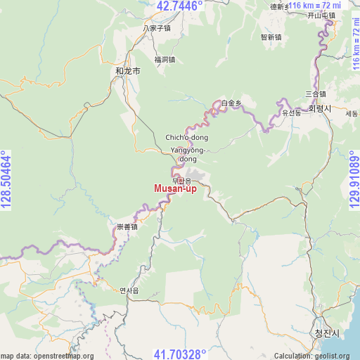
Musan-ŭp GPS coordinates[2]
42° 13' 33.924" North, 129° 12' 27.936" East
| Map corner | latitude | longitude |
|---|---|---|
| Upper-left | 42.7446°, | 128.50464° |
| Center: | 42.22609°, | 129.20776° |
| Lower-right: | 41.70328°, | 129.91089° |
| Map W x H: | 115.8×115.8 km | = 72×72mi |
| max Lat: | 42.95722° ⇑20.9% North |
| Musan-ŭp: | 42.22609° |
| min Lat: | ⇓79.1% South 37.90889° |
| min Long | Musan-ŭp | max Long |
| 124.39806° | 129.20776° | 130.49522° |
| W 69.2%⇐ | ⇒30.8% E |
Elevation
Elevation of Musan-ŭp is 478 m = 1568 ft, and this is 346.3 m = 1136 ft above average elevation for this country.
| Max E: |
1466 m = 4810 ft | 5.5% |
| Musan-ŭp | 478 m 1568 ft | |
| Avg. | 131.7 m = 432 ft | |
Min E: |
1 m = 3 ft | 94.5% |
See also: North Korea elevation on elevation.city.
Geographical zone
Musan-ŭp is located in North temperate zone (between Tropic of Cancer and the Arctic Circle). Distance of this Northern Tropic circle is 2089.2 km =1298.2 mi to South.| Distance of | km | miles | from Musan-ŭp |
|---|---|---|---|
| North Pole | 5312 | 3300.7 | to North |
| Arctic Circle | 2706.1 | 1681.5 | to North |
| Tropic Cancer | 2089.2 | 1298.2 | to South |
| Equator | 4695.1 | 2917.4 | to South |


Nearby cities:
15 places around Musan-ŭp: (largest is in red/bold)
• Chongjin
67 km =41.6 mi,  135°
135°
• Chungbong
67.9 km =42.2 mi,  54°
54°
• Hoemul-li
96 km =59.7 mi,  156°
156°
• Hoeryŏng
50.3 km =31.3 mi,  61°
61°
• Kogŏnwon
94.9 km =59 mi, 59°
• Komusan Il-tong
42.6 km =26.5 mi,  107°
107°
• Kyŏngsŏng
78.3 km =48.7 mi, 155°
• Namsan
3.8 km =2.4 mi,  87°
87°
• Nanam
69.3 km =43.1 mi,  145°
145°
• Puryŏng
45.4 km =28.2 mi, 113°
• Rajin
88.6 km =55.1 mi, 87°
• Sambong
70.4 km =43.7 mi,  43°
43°
• Sech’ŏn
64.8 km =40.3 mi, 52°
• Sŏng-dong
40.1 km =24.9 mi, 62°
• Sŭngam-nodongjagu
72.7 km =45.2 mi, 148°
Sources, notices
• [Note1] Compared only with cities in North Korea existing in our database
• [Src1] Map data: © OpenStreetMap contributors (CC-BY-SA)
• [Src2] Other city data from geonames.org with taken over terms of usage.
• [Src3] Geographical zone / Annual Mean Temperature by Robert A. Rohde @ Wikipedia
