Chongjin geodata
Chongjin (Hamgyŏng-bukto) is a seat of a first-order administrative division; located in North Korea in Asia/Pyongyang (GMT+9) time zone. With population of 327,000 people, there are 7 cities with bigger population in this country. Compared to other cities in North Korea, 75.8% of cities are located further ↓South; 82.4% of cities are located further ←West and 94.5% of cities have higher elevation than Chongjin. Note1


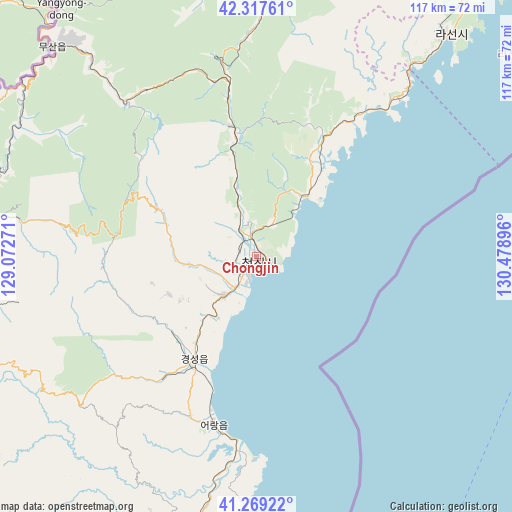
Chongjin GPS coordinates[2]
41° 47' 44.016" North, 129° 46' 32.988" East
| Map corner | latitude | longitude |
|---|---|---|
| Upper-left | 42.31761°, | 129.07271° |
| Center: | 41.79556°, | 129.77583° |
| Lower-right: | 41.26922°, | 130.47896° |
| Map W x H: | 116.6×116.6 km | = 72.5×72.5mi |
| max Lat: | 42.95722° ⇑24.2% North |
| Chongjin: | 41.79556° |
| min Lat: | ⇓75.8% South 37.90889° |
| min Long | Chongjin | max Long |
| 124.39806° | 129.77583° | 130.49522° |
| W 82.4%⇐ | ⇒17.6% E |
Elevation
Elevation of Chongjin is 5 m = 16 ft, and this is 126.7 m = 416 ft below average elevation for this country.
| Max E: |
1466 m = 4810 ft | 94.5% |
| Avg. | 131.7 m = 432 ft | |
| Chongjin | 5 m = 16 ft | |
Min E: |
1 m = 3 ft | 5.5% |
See also: Chongjin elevation on elevation.city.
Geographical zone
Chongjin is located in North temperate zone (between Tropic of Cancer and the Arctic Circle). Distance of this Northern Tropic circle is 2041.3 km =1268.4 mi to South.| Distance of | km | miles | from Chongjin |
|---|---|---|---|
| North Pole | 5359.8 | 3330.4 | to North |
| Arctic Circle | 2753.9 | 1711.2 | to North |
| Tropic Cancer | 2041.3 | 1268.4 | to South |
| Equator | 4647.2 | 2887.6 | to South |


Nearby cities:
15 places around Chongjin: (largest is in red/bold)
• Hau-ri
70.9 km =44.1 mi,  201°
201°
• Hoemul-li
41.2 km =25.6 mi,  192°
192°
• Hoeryŏng
71.8 km =44.6 mi,  358°
358°
• Komusan Il-tong
35.4 km =22 mi,  349°
349°
• Kyŏngsŏng
27.1 km =16.8 mi,  211°
211°
• Musan-ŭp
67 km =41.6 mi,  315°
315°
• Namsan
64.5 km =40.1 mi, 318°
• Nanam
11.9 km =7.4 mi,  219°
219°
• Puryŏng
29.9 km =18.6 mi, 349°
• Rajin
66.1 km =41.1 mi,  39°
39°
• Sŏnbong
79.6 km =49.5 mi, 39°
• Sŏng-dong
67.3 km =41.8 mi, 350°
• Sŭngam-nodongjagu
16.6 km =10.3 mi, 212°
• Ungsang
85.3 km =53 mi, 43°
• Ungsang-nodongjagu
84.4 km =52.4 mi, 42°
In other languages:
- In Spanish: Chŏngjin
- In German: Ch’ŏngjin
- In Russian: Чхончжине, Чхонджин
- In Chinese: 清津市
Sources, notices
• [Note1] Compared only with cities in North Korea existing in our database
• [Src1] Map data: © OpenStreetMap contributors (CC-BY-SA)
• [Src2] Other city data from geonames.org with taken over terms of usage.
• [Src3] Geographical zone / Annual Mean Temperature by Robert A. Rohde @ Wikipedia
