Sŭngam-nodongjagu geodata
Sŭngam-nodongjagu (Hamgyŏng-bukto) is a populated place; located in North Korea in Asia/Pyongyang (GMT+9) time zone. With population of 11,406 people, there are 71 cities with bigger population in this country. Compared to other cities in North Korea, 73.6% of cities are located further ↓South; 75.8% of cities are located further ←West and 85.7% of cities have higher elevation than Sŭngam-nodongjagu. Note1


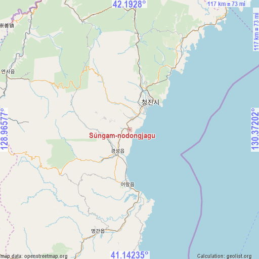
Sŭngam-nodongjagu GPS coordinates[2]
41° 40' 10.992" North, 129° 40' 8.004" East
| Map corner | latitude | longitude |
|---|---|---|
| Upper-left | 42.1928°, | 128.96577° |
| Center: | 41.66972°, | 129.66889° |
| Lower-right: | 41.14235°, | 130.37202° |
| Map W x H: | 116.8×116.8 km | = 72.6×72.6mi |
| max Lat: | 42.95722° ⇑26.4% North |
| Sŭngam-nodongjagu: | 41.66972° |
| min Lat: | ⇓73.6% South 37.90889° |
| min Long | Sŭngam-nodongj | max Long |
| 124.39806° | 129.66889° | 130.49522° |
| W 75.8%⇐ | ⇒24.2% E |
Elevation
Elevation of Sŭngam-nodongjagu is 12 m = 39 ft, and this is 119.7 m = 393 ft below average elevation for this country.
| Max E: |
1466 m = 4810 ft | 85.7% |
| Avg. | 131.7 m = 432 ft | |
| Sŭngam-nodongjagu | 12 m = 39 ft | |
Min E: |
1 m = 3 ft | 14.3% |
See also: North Korea elevation on elevation.city.
Geographical zone
Sŭngam-nodongjagu is located in North temperate zone (between Tropic of Cancer and the Arctic Circle). Distance of this Northern Tropic circle is 2027.3 km =1259.7 mi to South.| Distance of | km | miles | from Sŭngam-nodongjagu |
|---|---|---|---|
| North Pole | 5373.8 | 3339.1 | to North |
| Arctic Circle | 2767.9 | 1719.9 | to North |
| Tropic Cancer | 2027.3 | 1259.7 | to South |
| Equator | 4633.2 | 2878.9 | to South |


Nearby cities:
15 places around Sŭngam-nodongjagu: (largest is in red/bold)
• Chongjin
16.6 km =10.3 mi,  32°
32°
• Hau-ri
54.7 km =34 mi,  197°
197°
• Hoemul-li
26.2 km =16.3 mi,  179°
179°
• Hoeryŏng
86 km =53.4 mi,  4°
4°
• Kilju
83.5 km =51.9 mi, 199°
• Komusan Il-tong
48.9 km =30.4 mi, 3°
• Kyŏngsŏng
10.5 km =6.5 mi,  209°
209°
• Musan-ŭp
72.7 km =45.2 mi,  328°
328°
• Namsan
70.9 km =44.1 mi, 331°
• Nanam
5 km =3.1 mi,  14°
14°
• Puryŏng
43.6 km =27.1 mi, 4°
• Rajin
82.6 km =51.3 mi,  37°
37°
• Sŏnbong
96 km =59.7 mi, 37°
• Sŏng-dong
80.4 km =50 mi,  358°
358°
• Sŭngjibaegam
86.7 km =53.9 mi,  236°
236°
Sources, notices
• [Note1] Compared only with cities in North Korea existing in our database
• [Src1] Map data: © OpenStreetMap contributors (CC-BY-SA)
• [Src2] Other city data from geonames.org with taken over terms of usage.
• [Src3] Geographical zone / Annual Mean Temperature by Robert A. Rohde @ Wikipedia
