Nanam geodata
Nanam (Hamgyŏng-bukto) is a populated place; located in North Korea in Asia/Pyongyang (GMT+9) time zone. With population of 34,055 people, there are 32 cities with bigger population in this country. Compared to other cities in North Korea, 74.7% of cities are located further ↓South; 78% of cities are located further ←West and 63.7% of cities have higher elevation than Nanam. Note1


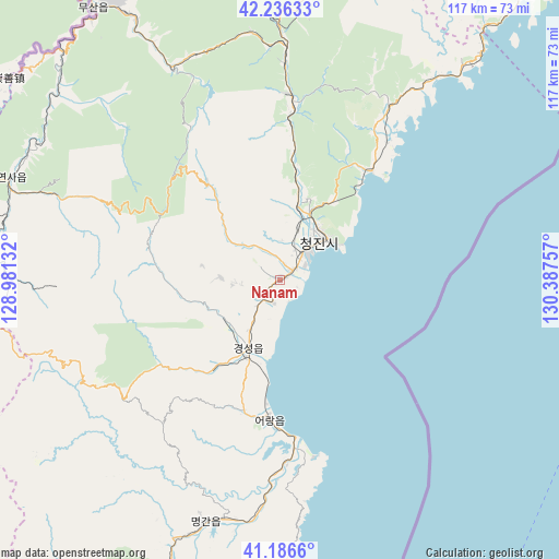
Nanam GPS coordinates[2]
41° 42' 48.996" North, 129° 41' 3.984" East
| Map corner | latitude | longitude |
|---|---|---|
| Upper-left | 42.23633°, | 128.98132° |
| Center: | 41.71361°, | 129.68444° |
| Lower-right: | 41.1866°, | 130.38757° |
| Map W x H: | 116.7×116.7 km | = 72.5×72.5mi |
| max Lat: | 42.95722° ⇑25.3% North |
| Nanam: | 41.71361° |
| min Lat: | ⇓74.7% South 37.90889° |
| min Long | Nanam | max Long |
| 124.39806° | 129.68444° | 130.49522° |
| W 78%⇐ | ⇒22% E |
Elevation
Elevation of Nanam is 24 m = 79 ft, and this is 107.7 m = 353 ft below average elevation for this country.
| Max E: |
1466 m = 4810 ft | 63.7% |
| Avg. | 131.7 m = 432 ft | |
| Nanam | 24 m = 79 ft | |
Min E: |
1 m = 3 ft | 36.3% |
See also: North Korea elevation on elevation.city.
Geographical zone
Nanam is located in North temperate zone (between Tropic of Cancer and the Arctic Circle). Distance of this Northern Tropic circle is 2032.2 km =1262.8 mi to South.| Distance of | km | miles | from Nanam |
|---|---|---|---|
| North Pole | 5368.9 | 3336.1 | to North |
| Arctic Circle | 2763.1 | 1716.9 | to North |
| Tropic Cancer | 2032.2 | 1262.8 | to South |
| Equator | 4638.1 | 2882 | to South |


Nearby cities:
15 places around Nanam: (largest is in red/bold)
• Chongjin
11.9 km =7.4 mi,  39°
39°
• Hau-ri
59.8 km =37.2 mi,  197°
197°
• Hoemul-li
31.1 km =19.3 mi,  182°
182°
• Hoeryŏng
81.1 km =50.4 mi,  3°
3°
• Kilju
88.5 km =55 mi, 199°
• Komusan Il-tong
44 km =27.3 mi, 1°
• Kyŏngsŏng
15.4 km =9.6 mi, 204°
• Musan-ŭp
69.3 km =43.1 mi,  325°
325°
• Namsan
67.3 km =41.8 mi, 328°
• Puryŏng
38.6 km =24 mi, 3°
• Rajin
78 km =48.5 mi, 39°
• Sŏnbong
91.4 km =56.8 mi, 39°
• Sŏng-dong
75.6 km =47 mi,  357°
357°
• Sŭngam-nodongjagu
5 km =3.1 mi,  194°
194°
• Sŭngjibaegam
90.5 km =56.2 mi,  234°
234°
Sources, notices
• [Note1] Compared only with cities in North Korea existing in our database
• [Src1] Map data: © OpenStreetMap contributors (CC-BY-SA)
• [Src2] Other city data from geonames.org with taken over terms of usage.
• [Src3] Geographical zone / Annual Mean Temperature by Robert A. Rohde @ Wikipedia
