Gumi geodata
Gumi (Gyeongsangbuk-do) is a populated place; located in South Korea in Asia/Seoul (GMT+9) time zone. With population of 291,006 people, there are 26 cities with bigger population in this country. Compared to other cities in South Korea, 52.4% of cities are located further ↓South; 82.5% of cities are located further ←West and 63.6% of cities have lower elevation than Gumi. Note1


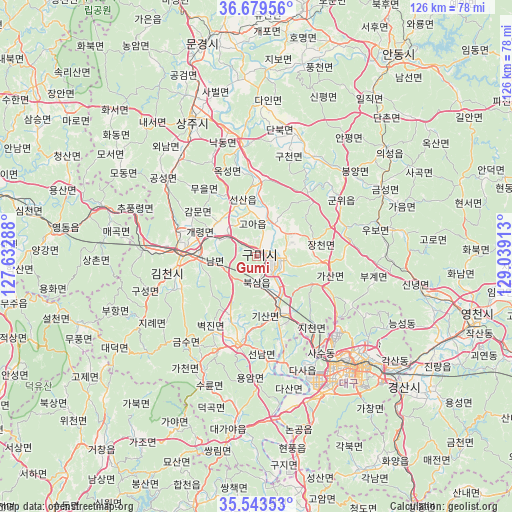
Gumi GPS coordinates[2]
36° 6' 48.96" North, 128° 20' 9.6" East
| Map corner | latitude | longitude |
|---|---|---|
| Upper-left | 36.67956°, | 127.63288° |
| Center: | 36.1136°, | 128.336° |
| Lower-right: | 35.54353°, | 129.03913° |
| Map W x H: | 126.3×126.3 km | = 78.5×78.5mi |
| max Lat: | 38.37881° ⇑47.6% North |
| Gumi: | 36.1136° |
| min Lat: | ⇓52.4% South 33.25333° |
| min Long | Gumi | max Long |
| 126.10863° | 128.336° | 129.55377° |
| W 82.5%⇐ | ⇒17.5% E |
Elevation
Elevation of Gumi is 63 m = 207 ft, and this is 7.4 m = 24 ft below average elevation for this country.
| Max E: |
691 m = 2267 ft | 36.4% |
| Avg. | 70.4 m = 231 ft | |
| Gumi | 63 m = 207 ft | |
Min E: |
1 m = 3 ft | 63.6% |
See also: Gumi elevation on elevation.city.
Geographical zone
Gumi is located in North temperate zone (between Tropic of Cancer and the Arctic Circle). Distance of this Northern Tropic circle is 1409.5 km =875.8 mi to South.| Distance of | km | miles | from Gumi |
|---|---|---|---|
| North Pole | 5991.6 | 3723 | to North |
| Arctic Circle | 3385.7 | 2103.8 | to North |
| Tropic Cancer | 1409.5 | 875.8 | to South |
| Equator | 4015.5 | 2495.1 | to South |


Nearby cities:
15 places around Gumi: (largest is in red/bold)
• Chupungnyeong
33 km =20.5 mi,  290°
290°
• Daegu
35.5 km =22.1 mi,  139°
139°
• Gimcheon
19.4 km =12.1 mi,  272°
272°
• Gyeongsan-si
48.5 km =30.1 mi,  131°
131°
• Hayang
48.9 km =30.4 mi,  117°
117°
• Hwanam
53.6 km =33.3 mi,  314°
314°
• Hwanggan
40.6 km =25.2 mi, 288°
• Hwawŏn
37.7 km =23.4 mi,  156°
156°
• Hyeonpung
47.5 km =29.5 mi,  167°
167°
• Jenzan
14.6 km =9.1 mi,  346°
346°
• Kunwi
25.2 km =15.7 mi,  57°
57°
• Sangju
37 km =23 mi,  334°
334°
• Waegwan
14.6 km =9.1 mi, 157°
• Yeongdong
50.7 km =31.5 mi,  277°
277°
• Yongsan
48.4 km =30.1 mi, 289°
Sources, notices
• [Note1] Compared only with cities in South Korea existing in our database
• [Src1] Map data: © OpenStreetMap contributors (CC-BY-SA)
• [Src2] Other city data from geonames.org with taken over terms of usage.
• [Src3] Geographical zone / Annual Mean Temperature by Robert A. Rohde @ Wikipedia
