Kunwi geodata
Kunwi (Gyeongsangbuk-do) is a populated place; located in South Korea in Asia/Seoul (GMT+9) time zone. With population of 34,293 people, there are 99 cities with bigger population in this country. Compared to other cities in South Korea, 56.3% of cities are located further ↓South; 86.7% of cities are located further ←West and 76.6% of cities have lower elevation than Kunwi. Note1


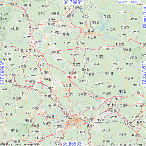
Kunwi GPS coordinates[2]
36° 14' 4.992" North, 128° 34' 22.008" East
| Map corner | latitude | longitude |
|---|---|---|
| Upper-left | 36.7998°, | 127.86966° |
| Center: | 36.23472°, | 128.57278° |
| Lower-right: | 35.66553°, | 129.27591° |
| Map W x H: | 126.1×126.1 km | = 78.4×78.4mi |
| max Lat: | 38.37881° ⇑43.7% North |
| Kunwi: | 36.23472° |
| min Lat: | ⇓56.3% South 33.25333° |
| min Long | Kunwi | max Long |
| 126.10863° | 128.57278° | 129.55377° |
| W 86.7%⇐ | ⇒13.3% E |
Elevation
Elevation of Kunwi is 95 m = 312 ft, and this is 24.6 m = 81 ft above average elevation for this country.
| Max E: |
691 m = 2267 ft | 23.4% |
| Kunwi | 95 m 312 ft | |
| Avg. | 70.4 m = 231 ft | |
Min E: |
1 m = 3 ft | 76.6% |
See also: South Korea elevation on elevation.city.
Geographical zone
Kunwi is located in North temperate zone (between Tropic of Cancer and the Arctic Circle). Distance of this Northern Tropic circle is 1423 km =884.2 mi to South.| Distance of | km | miles | from Kunwi |
|---|---|---|---|
| North Pole | 5978.1 | 3714.6 | to North |
| Arctic Circle | 3372.3 | 2095.4 | to North |
| Tropic Cancer | 1423 | 884.2 | to South |
| Equator | 4028.9 | 2503.4 | to South |


Nearby cities:
15 places around Kunwi: (largest is in red/bold)
• Andong
39.2 km =24.4 mi,  20°
20°
• Cheongsong gun
48.7 km =30.3 mi,  62°
62°
• Chupungnyeong
52.1 km =32.4 mi,  267°
267°
• Daegu
40.6 km =25.2 mi,  177°
177°
• Eisen
43.8 km =27.2 mi,  132°
132°
• Gimcheon
42.6 km =26.5 mi,  252°
252°
• Gumi
25.2 km =15.7 mi,  237°
237°
• Gyeongsan-si
48.1 km =29.9 mi,  162°
162°
• Hayang
42.1 km =26.2 mi,  148°
148°
• Hwawŏn
48.6 km =30.2 mi,  187°
187°
• Jenzan
24.7 km =15.3 mi, 271°
• Mungyeong
52.1 km =32.4 mi,  320°
320°
• Sangju
42 km =26.1 mi,  298°
298°
• Waegwan
31.2 km =19.4 mi,  210°
210°
• Yecheon
48.2 km =30 mi,  347°
347°
Sources, notices
• [Note1] Compared only with cities in South Korea existing in our database
• [Src1] Map data: © OpenStreetMap contributors (CC-BY-SA)
• [Src2] Other city data from geonames.org with taken over terms of usage.
• [Src3] Geographical zone / Annual Mean Temperature by Robert A. Rohde @ Wikipedia
