Hyeonpung geodata
Hyeonpung (Daegu) is a seat of a third-order administrative division; located in South Korea in Asia/Seoul (GMT+9) time zone. In our database, there are 128 cities with bigger population. Compared to other cities in South Korea, 55.2% of cities are located further ↑North; 83.6% of cities are located further ←West and 62.2% of cities have higher elevation than Hyeonpung. Note1


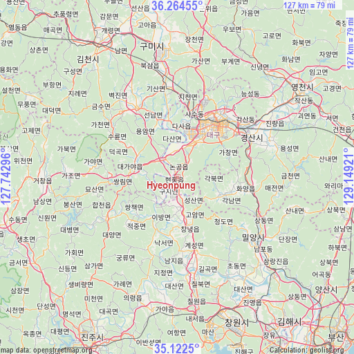
Hyeonpung GPS coordinates[2]
35° 41' 44.052" North, 128° 26' 45.888" East
| Map corner | latitude | longitude |
|---|---|---|
| Upper-left | 36.26455°, | 127.74296° |
| Center: | 35.69557°, | 128.44608° |
| Lower-right: | 35.1225°, | 129.14921° |
| Map W x H: | 127×127 km | = 78.9×78.9mi |
| max Lat: | 38.37881° ⇑55.2% North |
| Hyeonpung: | 35.69557° |
| min Lat: | ⇓44.8% South 33.25333° |
| min Long | Hyeonpung | max Long |
| 126.10863° | 128.44608° | 129.55377° |
| W 83.6%⇐ | ⇒16.4% E |
Elevation
Elevation of Hyeonpung is 29 m = 95 ft, and this is 41.4 m = 136 ft below average elevation for this country.
| Max E: |
691 m = 2267 ft | 62.2% |
| Avg. | 70.4 m = 231 ft | |
| Hyeonpung | 29 m = 95 ft | |
Min E: |
1 m = 3 ft | 37.8% |
See also: South Korea elevation on elevation.city.
Geographical zone
Hyeonpung is located in North temperate zone (between Tropic of Cancer and the Arctic Circle). Distance of this Northern Tropic circle is 1363.1 km =847 mi to South.| Distance of | km | miles | from Hyeonpung |
|---|---|---|---|
| North Pole | 6038.1 | 3751.9 | to North |
| Arctic Circle | 3432.2 | 2132.7 | to North |
| Tropic Cancer | 1363.1 | 847 | to South |
| Equator | 3969 | 2466.2 | to South |


Nearby cities:
15 places around Hyeonpung: (largest is in red/bold)
• Changnyeong
17.7 km =11 mi,  165°
165°
• Changwon
56.2 km =34.9 mi,  157°
157°
• Daegu
23.4 km =14.5 mi,  33°
33°
• Daehap
9.4 km =5.8 mi, 165°
• Eisen
53.1 km =33 mi,  55°
55°
• Gimcheon
55.8 km =34.7 mi,  328°
328°
• Gumi
47.5 km =29.5 mi,  347°
347°
• Gyeongsan-si
29.9 km =18.6 mi, 61°
• Hayang
41.5 km =25.8 mi,  54°
54°
• Hwawŏn
12.8 km =8 mi,  22°
22°
• Jenzan
62.1 km =38.6 mi, 347°
• Kunwi
61 km =37.9 mi,  10°
10°
• Miryang
35.4 km =22 mi,  129°
129°
• Naesŏ
50 km =31.1 mi, 172°
• Waegwan
33.3 km =20.7 mi, 352°
Sources, notices
• [Note1] Compared only with cities in South Korea existing in our database
• [Src1] Map data: © OpenStreetMap contributors (CC-BY-SA)
• [Src2] Other city data from geonames.org with taken over terms of usage.
• [Src3] Geographical zone / Annual Mean Temperature by Robert A. Rohde @ Wikipedia
