Hayang geodata
Hayang (Gyeongsangbuk-do) is a populated place; located in South Korea in Asia/Seoul (GMT+9) time zone. With population of 40,423 people, there are 94 cities with bigger population in this country. Compared to other cities in South Korea, 51.4% of cities are located further ↑North; 90.6% of cities are located further ←West and 60.8% of cities have lower elevation than Hayang. Note1


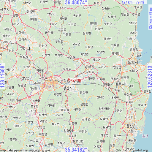
Hayang GPS coordinates[2]
35° 54' 47.988" North, 128° 49' 12" East
| Map corner | latitude | longitude |
|---|---|---|
| Upper-left | 36.48074°, | 128.11688° |
| Center: | 35.91333°, | 128.82° |
| Lower-right: | 35.34182°, | 129.52313° |
| Map W x H: | 126.6×126.6 km | = 78.7×78.7mi |
| max Lat: | 38.37881° ⇑51.4% North |
| Hayang: | 35.91333° |
| min Lat: | ⇓48.6% South 33.25333° |
| min Long | Hayang | max Long |
| 126.10863° | 128.82° | 129.55377° |
| W 90.6%⇐ | ⇒9.4% E |
Elevation
Elevation of Hayang is 57 m = 187 ft, and this is 13.4 m = 44 ft below average elevation for this country.
| Max E: |
691 m = 2267 ft | 39.2% |
| Avg. | 70.4 m = 231 ft | |
| Hayang | 57 m = 187 ft | |
Min E: |
1 m = 3 ft | 60.8% |
See also: Hayang elevation on elevation.city.
Geographical zone
Hayang is located in North temperate zone (between Tropic of Cancer and the Arctic Circle). Distance of this Northern Tropic circle is 1387.3 km =862 mi to South.| Distance of | km | miles | from Hayang |
|---|---|---|---|
| North Pole | 6013.9 | 3736.9 | to North |
| Arctic Circle | 3408 | 2117.6 | to North |
| Tropic Cancer | 1387.3 | 862 | to South |
| Equator | 3993.2 | 2481.3 | to South |


Nearby cities:
15 places around Hayang: (largest is in red/bold)
• Changnyeong
50.7 km =31.5 mi,  215°
215°
• Daegu
21.2 km =13.2 mi,  256°
256°
• Daehap
45.8 km =28.5 mi, 223°
• Eisen
11.7 km =7.3 mi,  58°
58°
• Gumi
48.9 km =30.4 mi,  297°
297°
• Gyeongju
36.1 km =22.4 mi,  102°
102°
• Gyeongsan-si
12.5 km =7.8 mi, 216°
• Hwawŏn
31.3 km =19.4 mi,  246°
246°
• Hyeonpung
41.5 km =25.8 mi,  234°
234°
• Kunwi
42.1 km =26.2 mi,  328°
328°
• Miryang
47.1 km =29.3 mi,  187°
187°
• Pohang
50.7 km =31.5 mi,  75°
75°
• Singwang
46.6 km =29 mi, 58°
• Waegwan
39 km =24.2 mi,  283°
283°
• Yeonil
48.7 km =30.3 mi, 79°
Sources, notices
• [Note1] Compared only with cities in South Korea existing in our database
• [Src1] Map data: © OpenStreetMap contributors (CC-BY-SA)
• [Src2] Other city data from geonames.org with taken over terms of usage.
• [Src3] Geographical zone / Annual Mean Temperature by Robert A. Rohde @ Wikipedia
