Hwawŏn geodata
Hwawŏn (Daegu) is a populated place; located in South Korea in Asia/Seoul (GMT+9) time zone. With population of 64,718 people, there are 71 cities with bigger population in this country. Compared to other cities in South Korea, 54.2% of cities are located further ↑North; 85.7% of cities are located further ←West and 54.2% of cities have higher elevation than Hwawŏn. Note1


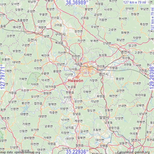
Hwawŏn GPS coordinates[2]
35° 48' 6.012" North, 128° 30' 2.988" East
| Map corner | latitude | longitude |
|---|---|---|
| Upper-left | 36.36989°, | 127.79771° |
| Center: | 35.80167°, | 128.50083° |
| Lower-right: | 35.22936°, | 129.20396° |
| Map W x H: | 126.8×126.8 km | = 78.8×78.8mi |
| max Lat: | 38.37881° ⇑54.2% North |
| Hwawŏn: | 35.80167° |
| min Lat: | ⇓45.8% South 33.25333° |
| min Long | Hwawŏn | max Long |
| 126.10863° | 128.50083° | 129.55377° |
| W 85.7%⇐ | ⇒14.3% E |
Elevation
Elevation of Hwawŏn is 36 m = 118 ft, and this is 34.4 m = 113 ft below average elevation for this country.
| Max E: |
691 m = 2267 ft | 54.2% |
| Avg. | 70.4 m = 231 ft | |
| Hwawŏn | 36 m = 118 ft | |
Min E: |
1 m = 3 ft | 45.8% |
See also: Hwawŏn elevation on elevation.city.
Geographical zone
Hwawŏn is located in North temperate zone (between Tropic of Cancer and the Arctic Circle). Distance of this Northern Tropic circle is 1374.9 km =854.3 mi to South.| Distance of | km | miles | from Hwawŏn |
|---|---|---|---|
| North Pole | 6026.3 | 3744.6 | to North |
| Arctic Circle | 3420.4 | 2125.3 | to North |
| Tropic Cancer | 1374.9 | 854.3 | to South |
| Equator | 3980.8 | 2473.6 | to South |


Nearby cities:
15 places around Hwawŏn: (largest is in red/bold)
• Changnyeong
28.9 km =18 mi,  181°
181°
• Daegu
11.2 km =7 mi,  46°
46°
• Daehap
21.1 km =13.1 mi,  187°
187°
• Eisen
42.9 km =26.7 mi,  64°
64°
• Gimcheon
49.4 km =30.7 mi,  316°
316°
• Gumi
37.7 km =23.4 mi,  336°
336°
• Gyeongju
64.2 km =39.9 mi,  85°
85°
• Gyeongsan-si
21.5 km =13.4 mi,  83°
83°
• Hayang
31.3 km =19.4 mi,  66°
66°
• Hyeonpung
12.8 km =8 mi,  202°
202°
• Jenzan
52.1 km =32.4 mi, 339°
• Kunwi
48.6 km =30.2 mi,  7°
7°
• Miryang
41 km =25.5 mi,  146°
146°
• Naesŏ
61.4 km =38.2 mi, 178°
• Waegwan
23.2 km =14.4 mi, 336°
Sources, notices
• [Note1] Compared only with cities in South Korea existing in our database
• [Src1] Map data: © OpenStreetMap contributors (CC-BY-SA)
• [Src2] Other city data from geonames.org with taken over terms of usage.
• [Src3] Geographical zone / Annual Mean Temperature by Robert A. Rohde @ Wikipedia
