Wabu geodata
Wabu (Gyeonggi-do) is a populated place; located in South Korea in Asia/Seoul (GMT+9) time zone. With population of 96,775 people, there are 49 cities with bigger population in this country. Compared to other cities in South Korea, 82.5% of cities are located further ↓South; 52.1% of cities are located further →East and 52.4% of cities have higher elevation than Wabu. Note1


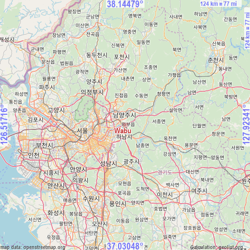
Wabu GPS coordinates[2]
37° 35' 22.992" North, 127° 13' 13.008" East
| Map corner | latitude | longitude |
|---|---|---|
| Upper-left | 38.14479°, | 126.51716° |
| Center: | 37.58972°, | 127.22028° |
| Lower-right: | 37.03048°, | 127.92341° |
| Map W x H: | 123.9×123.9 km | = 77×77mi |
| max Lat: | 38.37881° ⇑17.5% North |
| Wabu: | 37.58972° |
| min Lat: | ⇓82.5% South 33.25333° |
| min Long | Wabu | max Long |
| 126.10863° | 127.22028° | 129.55377° |
| W 47.9%⇐ | ⇒52.1% E |
Elevation
Elevation of Wabu is 38 m = 125 ft, and this is 32.4 m = 106 ft below average elevation for this country.
| Max E: |
691 m = 2267 ft | 52.4% |
| Avg. | 70.4 m = 231 ft | |
| Wabu | 38 m = 125 ft | |
Min E: |
1 m = 3 ft | 47.6% |
See also: Wabu elevation on elevation.city.
Geographical zone
Wabu is located in North temperate zone (between Tropic of Cancer and the Arctic Circle). Distance of this Northern Tropic circle is 1573.7 km =977.9 mi to South.| Distance of | km | miles | from Wabu |
|---|---|---|---|
| North Pole | 5827.5 | 3621 | to North |
| Arctic Circle | 3221.6 | 2001.8 | to North |
| Tropic Cancer | 1573.7 | 977.9 | to South |
| Equator | 4179.6 | 2597.1 | to South |


Nearby cities:
15 places around Wabu: (largest is in red/bold)
• Cheongpyeong
23.7 km =14.7 mi,  46°
46°
• Guri-si
7.2 km =4.5 mi,  277°
277°
• Gwangju
20.2 km =12.6 mi,  170°
170°
• Hanam
5.7 km =3.5 mi,  193°
193°
• Hwado
10.4 km =6.5 mi, 47°
• Jangheung
28.4 km =17.6 mi,  299°
299°
• Jinjeop
15.5 km =9.6 mi,  350°
350°
• Namyangju
5.2 km =3.2 mi, 354°
• Onam
12.1 km =7.5 mi, 353°
• Seongnam-si
18.3 km =11.4 mi,  203°
203°
• Seoul
21.5 km =13.4 mi,  262°
262°
• Su-dong
15.7 km =9.8 mi,  36°
36°
• Uijeongbu-si
22.7 km =14.1 mi,  317°
317°
• Yangp'yŏng
26.3 km =16.3 mi,  115°
115°
• Yongsan-dong
21.4 km =13.3 mi, 256°
Sources, notices
• [Note1] Compared only with cities in South Korea existing in our database
• [Src1] Map data: © OpenStreetMap contributors (CC-BY-SA)
• [Src2] Other city data from geonames.org with taken over terms of usage.
• [Src3] Geographical zone / Annual Mean Temperature by Robert A. Rohde @ Wikipedia
