Su-dong geodata
Su-dong (Gyeonggi-do) is a seat of a third-order administrative division; located in South Korea in Asia/Seoul (GMT+9) time zone. In our database, there are 128 cities with bigger population. Compared to other cities in South Korea, 85.7% of cities are located further ↓South; 52.8% of cities are located further ←West and 67.1% of cities have lower elevation than Su-dong. Note1


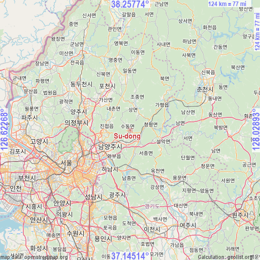
Su-dong GPS coordinates[2]
37° 42' 12.708" North, 127° 19' 32.88" East
| Map corner | latitude | longitude |
|---|---|---|
| Upper-left | 38.25774°, | 126.62268° |
| Center: | 37.70353°, | 127.3258° |
| Lower-right: | 37.14514°, | 128.02893° |
| Map W x H: | 123.7×123.7 km | = 76.9×76.9mi |
| max Lat: | 38.37881° ⇑14.3% North |
| Su-dong: | 37.70353° |
| min Lat: | ⇓85.7% South 33.25333° |
| min Long | Su-dong | max Long |
| 126.10863° | 127.3258° | 129.55377° |
| W 52.8%⇐ | ⇒47.2% E |
Elevation
Elevation of Su-dong is 71 m = 233 ft, and this is 0.59999999999999 m = 2 ft above average elevation for this country.
| Max E: |
691 m = 2267 ft | 32.9% |
| Su-dong | 71 m 233 ft | |
| Avg. | 70.4 m = 231 ft | |
Min E: |
1 m = 3 ft | 67.1% |
See also: South Korea elevation on elevation.city.
Geographical zone
Su-dong is located in North temperate zone (between Tropic of Cancer and the Arctic Circle). Distance of this Northern Tropic circle is 1586.3 km =985.7 mi to South.| Distance of | km | miles | from Su-dong |
|---|---|---|---|
| North Pole | 5814.8 | 3613.1 | to North |
| Arctic Circle | 3208.9 | 1993.9 | to North |
| Tropic Cancer | 1586.3 | 985.7 | to South |
| Equator | 4192.2 | 2604.9 | to South |


Nearby cities:
15 places around Su-dong: (largest is in red/bold)
• Cheongpyeong
8.8 km =5.5 mi,  66°
66°
• Gapyeong
21.6 km =13.4 mi,  48°
48°
• Guri-si
20.1 km =12.5 mi,  234°
234°
• Gwangjeok
33 km =20.5 mi,  294°
294°
• Gwangju
33.2 km =20.6 mi,  190°
190°
• Hanam
21 km =13 mi,  210°
210°
• Hwado
5.9 km =3.7 mi,  195°
195°
• Jinjeop
12.2 km =7.6 mi,  282°
282°
• Namyangju
12.3 km =7.6 mi, 232°
• Onam
10.6 km =6.6 mi,  266°
266°
• Seongnam-si
33.8 km =21 mi, 209°
• Uijeongbu-si
24.8 km =15.4 mi, 279°
• Wabu
15.7 km =9.8 mi,  216°
216°
• Yangju
27.3 km =17 mi,  301°
301°
• Yangp'yŏng
27.9 km =17.3 mi,  148°
148°
Sources, notices
• [Note1] Compared only with cities in South Korea existing in our database
• [Src1] Map data: © OpenStreetMap contributors (CC-BY-SA)
• [Src2] Other city data from geonames.org with taken over terms of usage.
• [Src3] Geographical zone / Annual Mean Temperature by Robert A. Rohde @ Wikipedia
