Anyang-si geodata
Anyang-si (Gyeonggi-do) is a populated place; located in South Korea in Asia/Seoul (GMT+9) time zone. With population of 634,367 people, there are 14 cities with bigger population in this country. Compared to other cities in South Korea, 77.6% of cities are located further ↓South; 70.3% of cities are located further →East and 58.4% of cities have lower elevation than Anyang-si. Note1


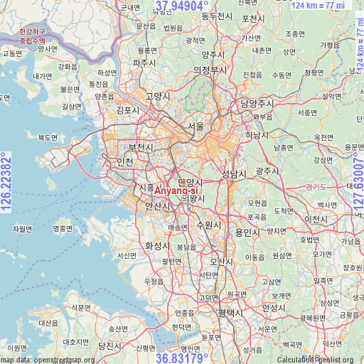
Anyang-si GPS coordinates[2]
37° 23' 33" North, 126° 55' 36.984" East
| Map corner | latitude | longitude |
|---|---|---|
| Upper-left | 37.94904°, | 126.22382° |
| Center: | 37.3925°, | 126.92694° |
| Lower-right: | 36.83179°, | 127.63007° |
| Map W x H: | 124.2×124.2 km | = 77.2×77.2mi |
| max Lat: | 38.37881° ⇑22.4% North |
| Anyang-si: | 37.3925° |
| min Lat: | ⇓77.6% South 33.25333° |
| min Long | Anyang-si | max Long |
| 126.10863° | 126.92694° | 129.55377° |
| W 29.7%⇐ | ⇒70.3% E |
Elevation
Elevation of Anyang-si is 52 m = 171 ft, and this is 18.4 m = 60 ft below average elevation for this country.
| Max E: |
691 m = 2267 ft | 41.6% |
| Avg. | 70.4 m = 231 ft | |
| Anyang-si | 52 m = 171 ft | |
Min E: |
1 m = 3 ft | 58.4% |
See also: Anyang-si elevation on elevation.city.
Geographical zone
Anyang-si is located in North temperate zone (between Tropic of Cancer and the Arctic Circle). Distance of this Northern Tropic circle is 1551.7 km =964.2 mi to South.| Distance of | km | miles | from Anyang-si |
|---|---|---|---|
| North Pole | 5849.4 | 3634.6 | to North |
| Arctic Circle | 3243.5 | 2015.4 | to North |
| Tropic Cancer | 1551.7 | 964.2 | to South |
| Equator | 4157.7 | 2583.5 | to South |


Nearby cities:
15 places around Anyang-si: (largest is in red/bold)
• Ansan-si
12 km =7.5 mi,  230°
230°
• Bucheon-si
17.4 km =10.8 mi,  312°
312°
• Bupyeong
22 km =13.7 mi,  304°
304°
• Guri-si
29.6 km =18.4 mi,  39°
39°
• Gwangju
29.2 km =18.1 mi,  86°
86°
• Hanam
29.6 km =18.4 mi,  56°
56°
• Hwaseong-si
22.8 km =14.2 mi,  205°
205°
• Incheon
20.8 km =12.9 mi,  289°
289°
• Kwangmyŏng
10.8 km =6.7 mi,  330°
330°
• Osan
29.6 km =18.4 mi,  154°
154°
• Paripark
16.5 km =10.3 mi,  344°
344°
• Seongnam-si
19.3 km =12 mi,  74°
74°
• Seoul
19.8 km =12.3 mi,  13°
13°
• Suwon
13.4 km =8.3 mi, 147°
• Yongsan-dong
17.6 km =10.9 mi,  16°
16°
Sources, notices
• [Note1] Compared only with cities in South Korea existing in our database
• [Src1] Map data: © OpenStreetMap contributors (CC-BY-SA)
• [Src2] Other city data from geonames.org with taken over terms of usage.
• [Src3] Geographical zone / Annual Mean Temperature by Robert A. Rohde @ Wikipedia
