Hanam geodata
Hanam (Gyeonggi-do) is a populated place; located in South Korea in Asia/Seoul (GMT+9) time zone. With population of 134,902 people, there are 43 cities with bigger population in this country. Compared to other cities in South Korea, 81.1% of cities are located further ↓South; 53.5% of cities are located further →East and 58.4% of cities have higher elevation than Hanam. Note1


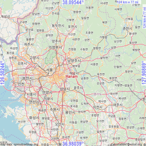
Hanam GPS coordinates[2]
37° 32' 24" North, 127° 12' 20.016" East
| Map corner | latitude | longitude |
|---|---|---|
| Upper-left | 38.09544°, | 126.50244° |
| Center: | 37.54°, | 127.20556° |
| Lower-right: | 36.98039°, | 127.90869° |
| Map W x H: | 124×124 km | = 77.1×77.1mi |
| max Lat: | 38.37881° ⇑18.9% North |
| Hanam: | 37.54° |
| min Lat: | ⇓81.1% South 33.25333° |
| min Long | Hanam | max Long |
| 126.10863° | 127.20556° | 129.55377° |
| W 46.5%⇐ | ⇒53.5% E |
Elevation
Elevation of Hanam is 33 m = 108 ft, and this is 37.4 m = 123 ft below average elevation for this country.
| Max E: |
691 m = 2267 ft | 58.4% |
| Avg. | 70.4 m = 231 ft | |
| Hanam | 33 m = 108 ft | |
Min E: |
1 m = 3 ft | 41.6% |
See also: Hanam elevation on elevation.city.
Geographical zone
Hanam is located in North temperate zone (between Tropic of Cancer and the Arctic Circle). Distance of this Northern Tropic circle is 1568.1 km =974.4 mi to South.| Distance of | km | miles | from Hanam |
|---|---|---|---|
| North Pole | 5833 | 3624.5 | to North |
| Arctic Circle | 3227.1 | 2005.2 | to North |
| Tropic Cancer | 1568.1 | 974.4 | to South |
| Equator | 4174.1 | 2593.7 | to South |


Nearby cities:
15 places around Hanam: (largest is in red/bold)
• Cheongpyeong
28.6 km =17.8 mi,  40°
40°
• Guri-si
8.7 km =5.4 mi,  318°
318°
• Gwangju
15.2 km =9.4 mi,  162°
162°
• Hwado
15.4 km =9.6 mi, 35°
• Jinjeop
20.9 km =13 mi,  356°
356°
• Namyangju
10.8 km =6.7 mi,  4°
4°
• Onam
17.6 km =10.9 mi, 0°
• Paripark
29 km =18 mi,  268°
268°
• Seongnam-si
12.8 km =8 mi,  207°
207°
• Seoul
20.2 km =12.6 mi,  278°
278°
• Su-dong
21 km =13 mi,  30°
30°
• Uijeongbu-si
26.4 km =16.4 mi,  328°
328°
• Wabu
5.7 km =3.5 mi,  13°
13°
• Yangp'yŏng
25.7 km =16 mi,  102°
102°
• Yongsan-dong
19.6 km =12.2 mi, 271°
Sources, notices
• [Note1] Compared only with cities in South Korea existing in our database
• [Src1] Map data: © OpenStreetMap contributors (CC-BY-SA)
• [Src2] Other city data from geonames.org with taken over terms of usage.
• [Src3] Geographical zone / Annual Mean Temperature by Robert A. Rohde @ Wikipedia
