Ungsang geodata
Ungsang (Gyeongsangnam-do) is a populated place; located in South Korea in Asia/Seoul (GMT+9) time zone. With population of 83,360 people, there are 57 cities with bigger population in this country. Compared to other cities in South Korea, 64.7% of cities are located further ↑North; 94.8% of cities are located further ←West and 78.3% of cities have lower elevation than Ungsang. Note1


Ungsang GPS coordinates[2]
35° 24' 21.996" North, 129° 10' 6.996" East
| Map corner | latitude | longitude |
|---|---|---|
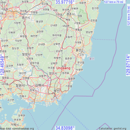
| Upper-left | 35.97716°, | 128.46549° |
| Center: | 35.40611°, | 129.16861° |
| Lower-right: | 34.83098°, | 129.87174° |
| Map W x H: | 127.4×127.4 km | = 79.2×79.2mi |
| max Lat: | 38.37881° ⇑64.7% North |
| Ungsang: | 35.40611° |
| min Lat: | ⇓35.3% South 33.25333° |
| min Long | Ungsang | max Long |
| 126.10863° | 129.16861° | 129.55377° |
| W 94.8%⇐ | ⇒5.2% E |
Elevation
Elevation of Ungsang is 101 m = 331 ft, and this is 30.6 m = 100 ft above average elevation for this country.
| Max E: |
691 m = 2267 ft | 21.7% |
| Ungsang | 101 m 331 ft | |
| Avg. | 70.4 m = 231 ft | |
Min E: |
1 m = 3 ft | 78.3% |
See also: Ungsang elevation on elevation.city.
Geographical zone
Ungsang is located in North temperate zone (between Tropic of Cancer and the Arctic Circle). Distance of this Northern Tropic circle is 1330.9 km =827 mi to South.| Distance of | km | miles | from Ungsang |
|---|---|---|---|
| North Pole | 6070.3 | 3771.9 | to North |
| Arctic Circle | 3464.4 | 2152.7 | to North |
| Tropic Cancer | 1330.9 | 827 | to South |
| Equator | 3936.8 | 2446.2 | to South |


Nearby cities:
15 places around Ungsang: (largest is in red/bold)
• Busan
36.1 km =22.4 mi,  200°
200°
• Changnyeong
62.8 km =39 mi,  283°
283°
• Changwon
48.5 km =30.1 mi,  245°
245°
• Dongnae
24 km =14.9 mi, 198°
• Gampo
53.6 km =33.3 mi,  34°
34°
• Gijang
18.5 km =11.5 mi,  167°
167°
• Gyeongju
48.7 km =30.3 mi,  4°
4°
• Gyeongsan-si
60.6 km =37.7 mi,  319°
319°
• Ilgwang
16.9 km =10.5 mi,  159°
159°
• Jangan
12.3 km =7.6 mi,  147°
147°
• Kimhae
32.3 km =20.1 mi,  233°
233°
• Miryang
39.2 km =24.4 mi, 284°
• Naesŏ
61.4 km =38.2 mi, 253°
• Ulsan
19.8 km =12.3 mi,  42°
42°
• Yangsan
14.2 km =8.8 mi,  239°
239°
Sources, notices
• [Note1] Compared only with cities in South Korea existing in our database
• [Src1] Map data: © OpenStreetMap contributors (CC-BY-SA)
• [Src2] Other city data from geonames.org with taken over terms of usage.
• [Src3] Geographical zone / Annual Mean Temperature by Robert A. Rohde @ Wikipedia
