Yangsan geodata
Yangsan (Gyeongsangnam-do) is a seat of a second-order administrative division; located in South Korea in Asia/Seoul (GMT+9) time zone. With population of 71,936 people, there are 69 cities with bigger population in this country. Compared to other cities in South Korea, 66.1% of cities are located further ↑North; 93.4% of cities are located further ←West and 97.6% of cities have higher elevation than Yangsan. Note1


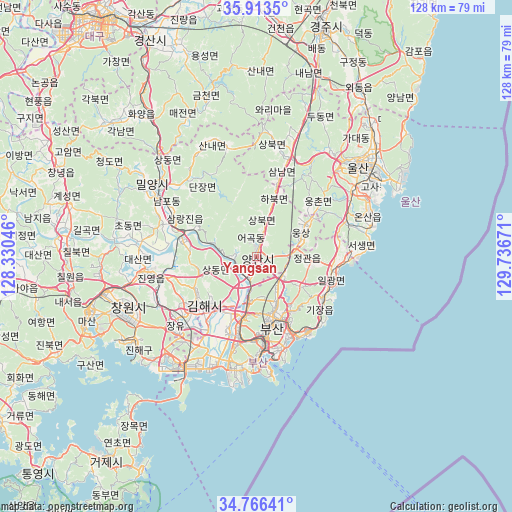
Yangsan GPS coordinates[2]
35° 20' 31.164" North, 129° 2' 0.888" East
| Map corner | latitude | longitude |
|---|---|---|
| Upper-left | 35.9135°, | 128.33046° |
| Center: | 35.34199°, | 129.03358° |
| Lower-right: | 34.76641°, | 129.73671° |
| Map W x H: | 127.5×127.5 km | = 79.2×79.2mi |
| max Lat: | 38.37881° ⇑66.1% North |
| Yangsan: | 35.34199° |
| min Lat: | ⇓33.9% South 33.25333° |
| min Long | Yangsan | max Long |
| 126.10863° | 129.03358° | 129.55377° |
| W 93.4%⇐ | ⇒6.6% E |
Elevation
Elevation of Yangsan is 6 m = 20 ft, and this is 64.4 m = 211 ft below average elevation for this country.
| Max E: |
691 m = 2267 ft | 97.6% |
| Avg. | 70.4 m = 231 ft | |
| Yangsan | 6 m = 20 ft | |
Min E: |
1 m = 3 ft | 2.4% |
See also: Yangsan elevation on elevation.city.
Geographical zone
Yangsan is located in North temperate zone (between Tropic of Cancer and the Arctic Circle). Distance of this Northern Tropic circle is 1323.7 km =822.5 mi to South.| Distance of | km | miles | from Yangsan |
|---|---|---|---|
| North Pole | 6077.4 | 3776.3 | to North |
| Arctic Circle | 3471.5 | 2157.1 | to North |
| Tropic Cancer | 1323.7 | 822.5 | to South |
| Equator | 3929.7 | 2441.8 | to South |


Nearby cities:
15 places around Yangsan: (largest is in red/bold)
• Busan
26.7 km =16.6 mi,  180°
180°
• Changnyeong
53.6 km =33.3 mi,  294°
294°
• Changwon
34.4 km =21.4 mi,  248°
248°
• Daehap
59.2 km =36.8 mi,  300°
300°
• Dongnae
16.3 km =10.1 mi,  163°
163°
• Gijang
19.6 km =12.2 mi,  123°
123°
• Gyeongju
58 km =36 mi,  16°
16°
• Ilgwang
20.1 km =12.5 mi, 115°
• Jangan
19.2 km =11.9 mi,  99°
99°
• Kimhae
18.3 km =11.4 mi,  229°
229°
• Miryang
30.8 km =19.1 mi, 303°
• Naesŏ
47.7 km =29.6 mi,  257°
257°
• Oepo
53.1 km =33 mi,  212°
212°
• Ulsan
33.6 km =20.9 mi,  49°
49°
• Ungsang
14.2 km =8.8 mi,  59°
59°
Sources, notices
• [Note1] Compared only with cities in South Korea existing in our database
• [Src1] Map data: © OpenStreetMap contributors (CC-BY-SA)
• [Src2] Other city data from geonames.org with taken over terms of usage.
• [Src3] Geographical zone / Annual Mean Temperature by Robert A. Rohde @ Wikipedia
