Changnyeong geodata
Changnyeong (Gyeongsangnam-do) is a populated place; located in South Korea in Asia/Seoul (GMT+9) time zone. With population of 74,668 people, there are 64 cities with bigger population in this country. Compared to other cities in South Korea, 59.4% of cities are located further ↑North; 85.3% of cities are located further ←West and 64.7% of cities have lower elevation than Changnyeong. Note1


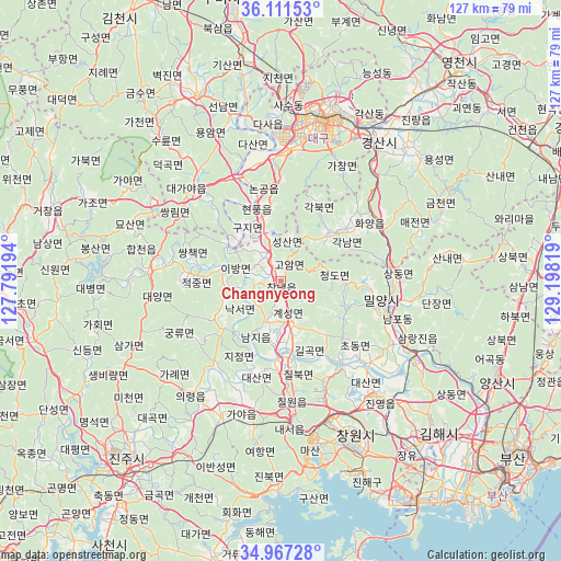
Changnyeong GPS coordinates[2]
35° 32' 29.22" North, 128° 29' 42.216" East
| Map corner | latitude | longitude |
|---|---|---|
| Upper-left | 36.11153°, | 127.79194° |
| Center: | 35.54145°, | 128.49506° |
| Lower-right: | 34.96728°, | 129.19819° |
| Map W x H: | 127.2×127.2 km | = 79×79mi |
| max Lat: | 38.37881° ⇑59.4% North |
| Changnyeong: | 35.54145° |
| min Lat: | ⇓40.6% South 33.25333° |
| min Long | Changnyeong | max Long |
| 126.10863° | 128.49506° | 129.55377° |
| W 85.3%⇐ | ⇒14.7% E |
Elevation
Elevation of Changnyeong is 66 m = 217 ft, and this is 4.4 m = 14 ft below average elevation for this country.
| Max E: |
691 m = 2267 ft | 35.3% |
| Avg. | 70.4 m = 231 ft | |
| Changnyeong | 66 m = 217 ft | |
Min E: |
1 m = 3 ft | 64.7% |
See also: Changnyeong elevation on elevation.city.
Geographical zone
Changnyeong is located in North temperate zone (between Tropic of Cancer and the Arctic Circle). Distance of this Northern Tropic circle is 1345.9 km =836.3 mi to South.| Distance of | km | miles | from Changnyeong |
|---|---|---|---|
| North Pole | 6055.2 | 3762.5 | to North |
| Arctic Circle | 3449.3 | 2143.3 | to North |
| Tropic Cancer | 1345.9 | 836.3 | to South |
| Equator | 3951.8 | 2455.5 | to South |


Nearby cities:
15 places around Changnyeong: (largest is in red/bold)
• Changwon
38.7 km =24 mi,  154°
154°
• Chinju
53.7 km =33.4 mi,  223°
223°
• Daegu
37.6 km =23.4 mi,  13°
13°
• Daehap
8.3 km =5.2 mi,  345°
345°
• Eisen
61.6 km =38.3 mi,  39°
39°
• Gyeongsan-si
38.2 km =23.7 mi,  34°
34°
• Hayang
50.7 km =31.5 mi, 35°
• Hwawŏn
28.9 km =18 mi,  1°
1°
• Hyeonpung
17.7 km =11 mi, 345°
• Kimhae
48.9 km =30.4 mi,  134°
134°
• Miryang
23.6 km =14.7 mi,  103°
103°
• Naesŏ
32.5 km =20.2 mi,  176°
176°
• Ungsang
62.8 km =39 mi, 103°
• Waegwan
50.9 km =31.6 mi, 350°
• Yangsan
53.6 km =33.3 mi,  114°
114°
Sources, notices
• [Note1] Compared only with cities in South Korea existing in our database
• [Src1] Map data: © OpenStreetMap contributors (CC-BY-SA)
• [Src2] Other city data from geonames.org with taken over terms of usage.
• [Src3] Geographical zone / Annual Mean Temperature by Robert A. Rohde @ Wikipedia
