Naesŏ geodata
Naesŏ (Gyeongsangnam-do) is a populated place; located in South Korea in Asia/Seoul (GMT+9) time zone. With population of 80,987 people, there are 61 cities with bigger population in this country. Compared to other cities in South Korea, 69.9% of cities are located further ↑North; 86% of cities are located further ←West and 62.6% of cities have lower elevation than Naesŏ. Note1


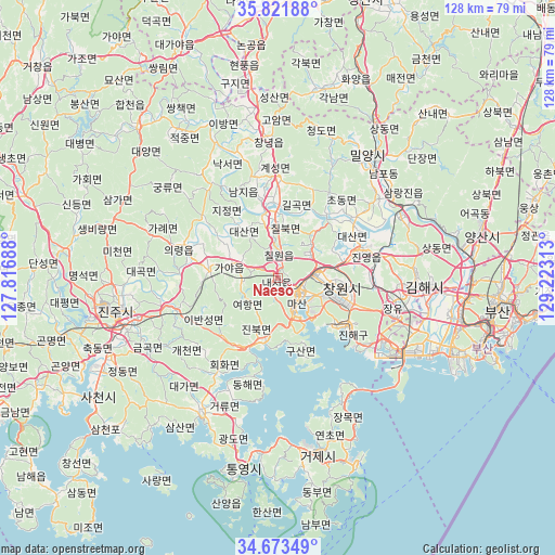
Naesŏ GPS coordinates[2]
35° 14' 58.992" North, 128° 31' 12" East
| Map corner | latitude | longitude |
|---|---|---|
| Upper-left | 35.82188°, | 127.81688° |
| Center: | 35.24972°, | 128.52° |
| Lower-right: | 34.67349°, | 129.22313° |
| Map W x H: | 127.7×127.7 km | = 79.3×79.3mi |
| max Lat: | 38.37881° ⇑69.9% North |
| Naesŏ: | 35.24972° |
| min Lat: | ⇓30.1% South 33.25333° |
| min Long | Naesŏ | max Long |
| 126.10863° | 128.52° | 129.55377° |
| W 86%⇐ | ⇒14% E |
Elevation
Elevation of Naesŏ is 62 m = 203 ft, and this is 8.4 m = 28 ft below average elevation for this country.
| Max E: |
691 m = 2267 ft | 37.4% |
| Avg. | 70.4 m = 231 ft | |
| Naesŏ | 62 m = 203 ft | |
Min E: |
1 m = 3 ft | 62.6% |
See also: Naesŏ elevation on elevation.city.
Geographical zone
Naesŏ is located in North temperate zone (between Tropic of Cancer and the Arctic Circle). Distance of this Northern Tropic circle is 1313.5 km =816.2 mi to South.| Distance of | km | miles | from Naesŏ |
|---|---|---|---|
| North Pole | 6087.7 | 3782.7 | to North |
| Arctic Circle | 3481.8 | 2163.5 | to North |
| Tropic Cancer | 1313.5 | 816.2 | to South |
| Equator | 3919.4 | 2435.4 | to South |


Nearby cities:
15 places around Naesŏ: (largest is in red/bold)
• Busan
49.2 km =30.6 mi,  109°
109°
• Changnyeong
32.5 km =20.2 mi,  356°
356°
• Changwon
14.8 km =9.2 mi,  99°
99°
• Chinju
40 km =24.9 mi,  260°
260°
• Daehap
40.7 km =25.3 mi,  353°
353°
• Dongnae
51.6 km =32.1 mi, 95°
• Goseong
35.3 km =21.9 mi,  210°
210°
• Hyeonpung
50 km =31.1 mi, 352°
• Kimhae
32.8 km =20.4 mi,  93°
93°
• Kyosai
44.9 km =27.9 mi,  171°
171°
• Miryang
34.1 km =21.2 mi,  37°
37°
• Oepo
38.8 km =24.1 mi,  152°
152°
• Sinhyeon
42 km =26.1 mi, 166°
• Ungsang
61.4 km =38.2 mi,  73°
73°
• Yangsan
47.7 km =29.6 mi,  77°
77°
Sources, notices
• [Note1] Compared only with cities in South Korea existing in our database
• [Src1] Map data: © OpenStreetMap contributors (CC-BY-SA)
• [Src2] Other city data from geonames.org with taken over terms of usage.
• [Src3] Geographical zone / Annual Mean Temperature by Robert A. Rohde @ Wikipedia
