Zharyk geodata
Zharyk (Karaganda) is a populated place; located in Kazakhstan in Asia/Almaty (GMT+5) time zone. With population of 2,940 people, there are 230 cities with bigger population in this country. Compared to other cities in Kazakhstan, 51.1% of cities are located further ↓South; 61.9% of cities are located further ←West and 86.7% of cities have lower elevation than Zharyk. Note1


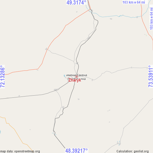
Zharyk GPS coordinates[2]
48° 51' 24.912" North, 72° 50' 9.528" East
| Map corner | latitude | longitude |
|---|---|---|
| Upper-left | 49.3174°, | 72.13286° |
| Center: | 48.85692°, | 72.83598° |
| Lower-right: | 48.39217°, | 73.53911° |
| Map W x H: | 102.9×102.9 km | = 63.9×63.9mi |
| max Lat: | 54.90596° ⇑48.9% North |
| Zharyk: | 48.85692° |
| min Lat: | ⇓51.1% South 40.66338° |
| min Long | Zharyk | max Long |
| 46.83361° | 72.83598° | 84.87144° |
| W 61.9%⇐ | ⇒38.1% E |
Elevation
Elevation of Zharyk is 655 m = 2149 ft, and this is 298.5 m = 979 ft above average elevation for this country.
| Max E: |
1847 m = 6060 ft | 13.3% |
| Zharyk | 655 m 2149 ft | |
| Avg. | 356.5 m = 1170 ft | |
Min E: |
-26 m = -85 ft | 86.7% |
See also: Kazakhstan elevation on elevation.city.
Geographical zone
Zharyk is located in North temperate zone (between Tropic of Cancer and the Arctic Circle). Distance of this North polar circle is 1968.8 km =1223.4 mi to North.| Distance of | km | miles | from Zharyk |
|---|---|---|---|
| North Pole | 4574.7 | 2842.6 | to North |
| Arctic Circle | 1968.8 | 1223.4 | to North |
| Tropic Cancer | 2826.5 | 1756.3 | to South |
| Equator | 5432.4 | 3375.5 | to South |


Nearby cities:
15 places around Zharyk: (largest is in red/bold)
• Abay
86.6 km =53.8 mi,  1°
1°
• Aksu-Ayuly
62.1 km =38.6 mi,  99°
99°
• Aktas
103 km =64 mi,  5°
5°
• Aktau
91.6 km =56.9 mi,  180°
180°
• Aqadyr
66.4 km =41.3 mi, 178°
• Atasū
89.3 km =55.5 mi,  257°
257°
• Dolinka
91.9 km =57.1 mi,  352°
352°
• Karagandy
106.8 km =66.4 mi, 10°
• Koktal
101.1 km =62.8 mi,  29°
29°
• Kyzylzhar
126.2 km =78.4 mi, 352°
• Novodolinskiy
94.9 km =59 mi, 354°
• Shakhan
107.8 km =67 mi, 352°
• Shakhtinsk
96.4 km =59.9 mi, 349°
• Soran
103.8 km =64.5 mi, 0°
• Verkhniye Kayrakty
38 km =23.6 mi,  120°
120°
Sources, notices
• [Note1] Compared only with cities in Kazakhstan existing in our database
• [Src1] Map data: © OpenStreetMap contributors (CC-BY-SA)
• [Src2] Other city data from geonames.org with taken over terms of usage.
• [Src3] Geographical zone / Annual Mean Temperature by Robert A. Rohde @ Wikipedia
