Atasū geodata
Atasū (Karaganda) is a populated place; located in Kazakhstan in Asia/Almaty (GMT+5) time zone. With population of 13,184 people, there are 92 cities with bigger population in this country. Compared to other cities in Kazakhstan, 51.9% of cities are located further ↑North; 55.6% of cities are located further ←West and 72.6% of cities have lower elevation than Atasū. Note1


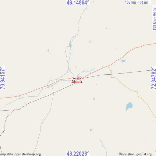
Atasū GPS coordinates[2]
48° 41' 11.724" North, 71° 38' 40.884" East
| Map corner | latitude | longitude |
|---|---|---|
| Upper-left | 49.14864°, | 70.94157° |
| Center: | 48.68659°, | 71.64469° |
| Lower-right: | 48.22026°, | 72.34782° |
| Map W x H: | 103.2×103.2 km | = 64.1×64.1mi |
| max Lat: | 54.90596° ⇑51.9% North |
| Atasū: | 48.68659° |
| min Lat: | ⇓48.1% South 40.66338° |
| min Long | Atasū | max Long |
| 46.83361° | 71.64469° | 84.87144° |
| W 55.6%⇐ | ⇒44.4% E |
Elevation
Elevation of Atasū is 487 m = 1598 ft, and this is 130.5 m = 428 ft above average elevation for this country.
| Max E: |
1847 m = 6060 ft | 27.4% |
| Atasū | 487 m 1598 ft | |
| Avg. | 356.5 m = 1170 ft | |
Min E: |
-26 m = -85 ft | 72.6% |
See also: Kazakhstan elevation on elevation.city.
Geographical zone
Atasū is located in North temperate zone (between Tropic of Cancer and the Arctic Circle). Distance of this North polar circle is 1987.7 km =1235.1 mi to North.| Distance of | km | miles | from Atasū |
|---|---|---|---|
| North Pole | 4593.6 | 2854.3 | to North |
| Arctic Circle | 1987.7 | 1235.1 | to North |
| Tropic Cancer | 2807.5 | 1744.5 | to South |
| Equator | 5413.4 | 3363.7 | to South |


Nearby cities:
15 places around Atasū: (largest is in red/bold)
• Abay
137.7 km =85.6 mi,  39°
39°
• Aksu-Ayuly
149 km =92.6 mi,  86°
86°
• Aktas
154.6 km =96.1 mi, 38°
• Aktau
114 km =70.8 mi,  129°
129°
• Aqadyr
101.3 km =62.9 mi,  117°
117°
• Dolinka
133.3 km =82.8 mi,  34°
34°
• Karagandy
163 km =101.3 mi, 40°
• Kyzylzhar
160 km =99.4 mi, 25°
• Novodolinskiy
137.2 km =85.3 mi, 34°
• Qarazhal
98.3 km =61.1 mi,  219°
219°
• Shakhan
145.7 km =90.5 mi, 30°
• Shakhtinsk
132.9 km =82.6 mi, 31°
• Soran
150.2 km =93.3 mi, 35°
• Verkhniye Kayrakty
120.3 km =74.8 mi, 90°
• Zharyk
89.3 km =55.5 mi,  77°
77°
Sources, notices
• [Note1] Compared only with cities in Kazakhstan existing in our database
• [Src1] Map data: © OpenStreetMap contributors (CC-BY-SA)
• [Src2] Other city data from geonames.org with taken over terms of usage.
• [Src3] Geographical zone / Annual Mean Temperature by Robert A. Rohde @ Wikipedia
