Baabda geodata
Baabda (Mont-Liban) is a seat of a first-order administrative division; located in Lebanon in Asia/Beirut (GMT+3) time zone. With population of 9,000 people, there are 14 cities with bigger population in this country. Compared to other cities in Lebanon, 53.1% of cities are located further ↓South; 71.9% of cities are located further →East and 62.5% of cities have higher elevation than Baabda. Note1


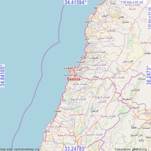
Baabda GPS coordinates[2]
33° 50' 2.004" North, 35° 32' 39.012" East
| Map corner | latitude | longitude |
|---|---|---|
| Upper-left | 34.41594°, | 34.84105° |
| Center: | 33.83389°, | 35.54417° |
| Lower-right: | 33.24785°, | 36.2473° |
| Map W x H: | 129.9×129.9 km | = 80.7×80.7mi |
| max Lat: | 34.54278° ⇑46.9% North |
| Baabda: | 33.83389° |
| min Lat: | ⇓53.1% South 33.11023° |
| min Long | Baabda | max Long |
| 35.13972° | 35.54417° | 36.38472° |
| W 28.1%⇐ | ⇒71.9% E |
Elevation
Elevation of Baabda is 215 m = 705 ft, and this is 340.2 m = 1116 ft below average elevation for this country.
| Max E: |
1442 m = 4731 ft | 62.5% |
| Avg. | 555.2 m = 1822 ft | |
| Baabda | 215 m = 705 ft | |
Min E: |
7 m = 23 ft | 37.5% |
See also: Lebanon elevation on elevation.city.
Geographical zone
Baabda is located in North temperate zone (between Tropic of Cancer and the Arctic Circle). Distance of this Northern Tropic circle is 1156.1 km =718.4 mi to South.| Distance of | km | miles | from Baabda |
|---|---|---|---|
| North Pole | 6245.1 | 3880.5 | to North |
| Arctic Circle | 3639.2 | 2261.3 | to North |
| Tropic Cancer | 1156.1 | 718.4 | to South |
| Equator | 3762 | 2337.6 | to South |


Nearby cities:
15 places around Baabda: (largest is in red/bold)
• Aaley
6.1 km =3.8 mi,  121°
121°
• Aanjar
37.7 km =23.4 mi,  108°
108°
• Beirut
7.7 km =4.8 mi,  329°
329°
• Beït ed Dîne
15.9 km =9.9 mi,  167°
167°
• Bhamdoun
10.8 km =6.7 mi, 113°
• Bhamdoûn el Mhatta
11 km =6.8 mi,  104°
104°
• Jbaïl
33.3 km =20.7 mi,  16°
16°
• Jdaidet el Matn
6.6 km =4.1 mi, 18°
• Jezzîne
32.7 km =20.3 mi, 173°
• Joubb Jannîne
32 km =19.9 mi,  136°
136°
• Jounieh
17.7 km =11 mi, 22°
• Ra’s Bayrūt
9.3 km =5.8 mi,  322°
322°
• Râchaïya el Ouadi
46.3 km =28.8 mi, 143°
• Sidon
34.6 km =21.5 mi,  207°
207°
• Zahlé
33.1 km =20.6 mi,  87°
87°
Sources, notices
• [Note1] Compared only with cities in Lebanon existing in our database
• [Src1] Map data: © OpenStreetMap contributors (CC-BY-SA)
• [Src2] Other city data from geonames.org with taken over terms of usage.
• [Src3] Geographical zone / Annual Mean Temperature by Robert A. Rohde @ Wikipedia
