Maseru geodata
Maseru is a capital of a political entity; located in Lesotho in Africa/Maseru (GMT+2) time zone. With population of 118,355 people, there are 0 cities with bigger population in this country. Compared to other cities in Lesotho, 54.5% of cities are located further ↓South; 81.8% of cities are located further →East and 90.9% of cities have higher elevation than Maseru. Note1


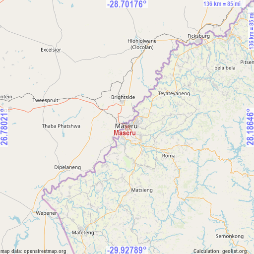
Maseru GPS coordinates[2]
29° 19' 0.012" South, 27° 28' 59.988" East
| Map corner | latitude | longitude |
|---|---|---|
| Upper-left | -28.70176°, | 26.78021° |
| Center: | -29.31667°, | 27.48333° |
| Lower-right: | -29.92789°, | 28.18646° |
| Map W x H: | 136.3×136.3 km | = 84.7×84.7mi |
| max Lat: | -28.76659° ⇑45.5% North |
| Maseru: | -29.31667° |
| min Lat: | ⇓54.5% South -30.40001° |
| min Long | Maseru | max Long |
| 27.23744° | 27.48333° | 29.06751° |
| W 18.2%⇐ | ⇒81.8% E |
Elevation
Elevation of Maseru is 1552 m = 5092 ft, and this is 214.2 m = 703 ft below average elevation for this country.
| Max E: |
2230 m = 7316 ft | 90.9% |
| Avg. | 1766.2 m = 5795 ft | |
| Maseru | 1552 m = 5092 ft | |
Min E: |
1515 m = 4970 ft | 9.1% |
See also: Maseru elevation on elevation.city.
Geographical zone
Maseru is located in South temperate zone (between Tropic of Capricorn and the Antarctic Circle). Distance of this Southern Tropic circle is 653.8 km =406.3 mi to North.| Distance of | km | miles | from Maseru |
|---|---|---|---|
| Equator | 3259.7 | 2025.5 | to North |
| Tropic Capricorn | 653.8 | 406.3 | to North |
| Antarctic Circle | 4141.5 | 2573.4 | to South |
| South Pole | 6747.4 | 4192.6 | to South |


Nearby cities:
11 places around Maseru: (largest is in red/bold)
• Butha-Buthe
96.4 km =59.9 mi,  50°
50°
• Leribe
73.7 km =45.8 mi, 47°
• Mafeteng
61.1 km =38 mi,  202°
202°
• Maputsoe
62.6 km =38.9 mi,  40°
40°
• Mohale’s Hoek
92.8 km =57.7 mi,  180°
180°
• Mokhotlong
153.6 km =95.4 mi,  88°
88°
• Nako
43.2 km =26.8 mi,  140°
140°
• Qacha’s Nek
146.5 km =91 mi,  127°
127°
• Quthing
122.3 km =76 mi,  170°
170°
• Teyateyaneng
31.9 km =19.8 mi, 53°
• Thaba-Tseka
111.3 km =69.2 mi,  101°
101°
Sources, notices
• [Note1] Compared only with cities in Lesotho existing in our database
• [Src1] Map data: © OpenStreetMap contributors (CC-BY-SA)
• [Src2] Other city data from geonames.org with taken over terms of usage.
• [Src3] Geographical zone / Annual Mean Temperature by Robert A. Rohde @ Wikipedia
