Leribe geodata
Leribe is a seat of a first-order administrative division; located in Lesotho in Africa/Maseru (GMT+2) time zone. With population of 47,675 people, there are 2 cities with bigger population in this country. Compared to other cities in Lesotho, 90.9% of cities are located further ↓South; 63.6% of cities are located further ←West and 63.6% of cities have higher elevation than Leribe. Note1


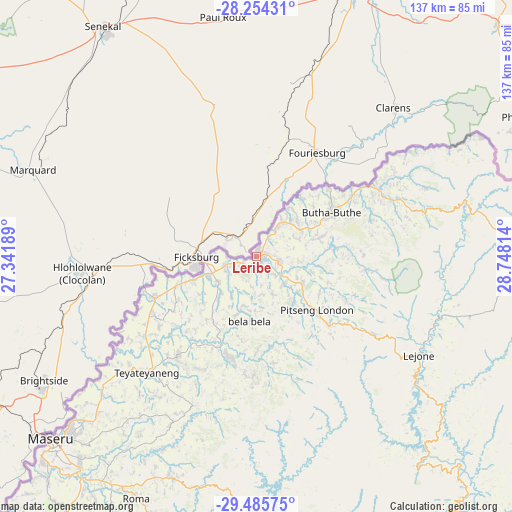
Leribe GPS coordinates[2]
28° 52' 18.66" South, 28° 2' 42.036" East
| Map corner | latitude | longitude |
|---|---|---|
| Upper-left | -28.25431°, | 27.34189° |
| Center: | -28.87185°, | 28.04501° |
| Lower-right: | -29.48575°, | 28.74814° |
| Map W x H: | 136.9×136.9 km | = 85.1×85.1mi |
| max Lat: | -28.76659° ⇑9.1% North |
| Leribe: | -28.87185° |
| min Lat: | ⇓90.9% South -30.40001° |
| min Long | Leribe | max Long |
| 27.23744° | 28.04501° | 29.06751° |
| W 63.6%⇐ | ⇒36.4% E |
Elevation
Elevation of Leribe is 1645 m = 5397 ft, and this is 121.2 m = 398 ft below average elevation for this country.
| Max E: |
2230 m = 7316 ft | 63.6% |
| Avg. | 1766.2 m = 5795 ft | |
| Leribe | 1645 m = 5397 ft | |
Min E: |
1515 m = 4970 ft | 36.4% |
See also: Leribe elevation on elevation.city.
Geographical zone
Leribe is located in South temperate zone (between Tropic of Capricorn and the Antarctic Circle). Distance of this Southern Tropic circle is 604.3 km =375.5 mi to North.| Distance of | km | miles | from Leribe |
|---|---|---|---|
| Equator | 3210.2 | 1994.7 | to North |
| Tropic Capricorn | 604.3 | 375.5 | to North |
| Antarctic Circle | 4190.9 | 2604.1 | to South |
| South Pole | 6796.8 | 4223.3 | to South |


Nearby cities:
11 places around Leribe: (largest is in red/bold)
• Butha-Buthe
23.1 km =14.4 mi,  59°
59°
• Mafeteng
131.6 km =81.8 mi,  216°
216°
• Maputsoe
14.3 km =8.9 mi,  263°
263°
• Maseru
73.7 km =45.8 mi,  227°
227°
• Mohale’s Hoek
152.5 km =94.8 mi,  201°
201°
• Mokhotlong
109.7 km =68.2 mi,  115°
115°
• Nako
87.1 km =54.1 mi, 198°
• Qacha’s Nek
151.7 km =94.3 mi,  155°
155°
• Quthing
173.2 km =107.6 mi,  191°
191°
• Teyateyaneng
42 km =26.1 mi, 223°
• Thaba-Tseka
90.6 km =56.3 mi,  142°
142°
Sources, notices
• [Note1] Compared only with cities in Lesotho existing in our database
• [Src1] Map data: © OpenStreetMap contributors (CC-BY-SA)
• [Src2] Other city data from geonames.org with taken over terms of usage.
• [Src3] Geographical zone / Annual Mean Temperature by Robert A. Rohde @ Wikipedia
