Švenčionys geodata
Švenčionys (Vilnius) is a populated place; located in Lithuania in Europe/Vilnius (GMT+3) time zone. With population of 5,538 people, there are 68 cities with bigger population in this country. Compared to other cities in Lithuania, 50% of cities are located further ↓South; 97% of cities are located further ←West and 99.3% of cities have lower elevation than Švenčionys. Note1


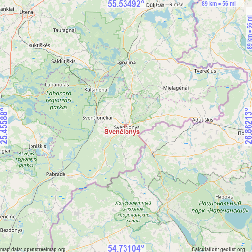
Švenčionys GPS coordinates[2]
55° 8' 6" North, 26° 9' 32.4" East
| Map corner | latitude | longitude |
|---|---|---|
| Upper-left | 55.53492°, | 25.45588° |
| Center: | 55.135°, | 26.159° |
| Lower-right: | 54.73104°, | 26.86213° |
| Map W x H: | 89.4×89.4 km | = 55.6×55.6mi |
| max Lat: | 56.36149° ⇑50% North |
| Švenčionys: | 55.135° |
| min Lat: | ⇓50% South 54.01573° |
| min Long | Švenčionys | max Long |
| 20.99651° | 26.159° | 26.43984° |
| W 97%⇐ | ⇒3% E |
Elevation
Elevation of Švenčionys is 200 m = 656 ft, and this is 109.3 m = 359 ft above average elevation for this country.
| Max E: |
204 m = 669 ft | 0.7% |
| Švenčionys | 200 m 656 ft | |
| Avg. | 90.7 m = 298 ft | |
Min E: |
-1 m = -3 ft | 99.3% |
See also: Lithuania elevation on elevation.city.
Geographical zone
Švenčionys is located in North temperate zone (between Tropic of Cancer and the Arctic Circle). Distance of this North polar circle is 1270.7 km =789.6 mi to North.| Distance of | km | miles | from Švenčionys |
|---|---|---|---|
| North Pole | 3876.6 | 2408.8 | to North |
| Arctic Circle | 1270.7 | 789.6 | to North |
| Tropic Cancer | 3524.5 | 2190 | to South |
| Equator | 6130.4 | 3809.3 | to South |


Nearby cities:
15 places around Švenčionys: (largest is in red/bold)
• Dusetos
70.8 km =44 mi,  343°
343°
• Dūkštas
44.2 km =27.5 mi,  13°
13°
• Fabijoniškės
73.7 km =45.8 mi,  232°
232°
• Ignalina
22.9 km =14.2 mi,  0°
0°
• Lavoriškės
58 km =36 mi,  214°
214°
• Molėtai
48.2 km =30 mi,  281°
281°
• Nemenčinė
54.3 km =33.7 mi, 233°
• Pabradė
30.6 km =19 mi,  235°
235°
• Pašilaičiai
74.8 km =46.5 mi, 233°
• Rasos
74.2 km =46.1 mi, 226°
• Utena
53.7 km =33.4 mi,  318°
318°
• Vilnius
74.9 km =46.5 mi, 228°
• Visaginas
54.3 km =33.7 mi,  19°
19°
• Zarasai
66.7 km =41.4 mi, 5°
• Švenčionėliai
10.4 km =6.5 mi,  286°
286°
Sources, notices
• [Note1] Compared only with cities in Lithuania existing in our database
• [Src1] Map data: © OpenStreetMap contributors (CC-BY-SA)
• [Src2] Other city data from geonames.org with taken over terms of usage.
• [Src3] Geographical zone / Annual Mean Temperature by Robert A. Rohde @ Wikipedia
