Švenčionėliai geodata
Švenčionėliai (Vilnius) is a populated place; located in Lithuania in Europe/Vilnius (GMT+3) time zone. With population of 6,790 people, there are 60 cities with bigger population in this country. Compared to other cities in Lithuania, 52.2% of cities are located further ↓South; 96.3% of cities are located further ←West and 90.3% of cities have lower elevation than Švenčionėliai. Note1


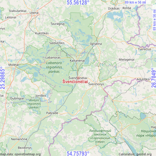
Švenčionėliai GPS coordinates[2]
55° 9' 41.868" North, 26° 0' 6.372" East
| Map corner | latitude | longitude |
|---|---|---|
| Upper-left | 55.56128°, | 25.29865° |
| Center: | 55.16163°, | 26.00177° |
| Lower-right: | 54.75793°, | 26.7049° |
| Map W x H: | 89.3×89.3 km | = 55.5×55.5mi |
| max Lat: | 56.36149° ⇑47.8% North |
| Švenčionėliai: | 55.16163° |
| min Lat: | ⇓52.2% South 54.01573° |
| min Long | Švenčionėlia | max Long |
| 20.99651° | 26.00177° | 26.43984° |
| W 96.3%⇐ | ⇒3.7% E |
Elevation
Elevation of Švenčionėliai is 160 m = 525 ft, and this is 69.3 m = 227 ft above average elevation for this country.
| Max E: |
204 m = 669 ft | 9.7% |
| Švenčionėliai | 160 m 525 ft | |
| Avg. | 90.7 m = 298 ft | |
Min E: |
-1 m = -3 ft | 90.3% |
See also: Lithuania elevation on elevation.city.
Geographical zone
Švenčionėliai is located in North temperate zone (between Tropic of Cancer and the Arctic Circle). Distance of this North polar circle is 1267.8 km =787.8 mi to North.| Distance of | km | miles | from Švenčionėliai |
|---|---|---|---|
| North Pole | 3873.7 | 2407 | to North |
| Arctic Circle | 1267.8 | 787.8 | to North |
| Tropic Cancer | 3527.5 | 2191.9 | to South |
| Equator | 6133.4 | 3811.1 | to South |


Nearby cities:
15 places around Švenčionėliai: (largest is in red/bold)
• Dusetos
65.8 km =40.9 mi,  351°
351°
• Dūkštas
44.9 km =27.9 mi,  26°
26°
• Fabijoniškės
68 km =42.3 mi,  225°
225°
• Ignalina
22.3 km =13.9 mi, 26°
• Lavoriškės
55.6 km =34.5 mi,  204°
204°
• Molėtai
37.8 km =23.5 mi,  280°
280°
• Nemenčinė
48.7 km =30.3 mi,  224°
224°
• Pabradė
25.3 km =15.7 mi, 217°
• Pašilaičiai
69 km =42.9 mi, 226°
• Rasos
69.5 km =43.2 mi, 219°
• Utena
45.2 km =28.1 mi,  325°
325°
• Visaginas
55.7 km =34.6 mi, 29°
• Zarasai
65.4 km =40.6 mi,  13°
13°
• Širvintos
67.9 km =42.2 mi,  258°
258°
• Švenčionys
10.4 km =6.5 mi,  106°
106°
Sources, notices
• [Note1] Compared only with cities in Lithuania existing in our database
• [Src1] Map data: © OpenStreetMap contributors (CC-BY-SA)
• [Src2] Other city data from geonames.org with taken over terms of usage.
• [Src3] Geographical zone / Annual Mean Temperature by Robert A. Rohde @ Wikipedia
