Kirchberg geodata
Kirchberg (Luxembourg) is a populated place; located in Luxembourg in Europe/Luxembourg (GMT+2) time zone. With population of 3,534 people, there are 22 cities with bigger population in this country. Compared to other cities in Luxembourg, 59.9% of cities are located further ↑North; 61% of cities are located further ←West and 83.1% of cities have lower elevation than Kirchberg. Note1


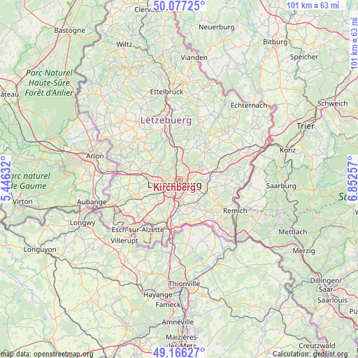
Kirchberg GPS coordinates[2]
49° 37' 26.004" North, 6° 8' 57.984" East
| Map corner | latitude | longitude |
|---|---|---|
| Upper-left | 50.07725°, | 5.44632° |
| Center: | 49.62389°, | 6.14944° |
| Lower-right: | 49.16627°, | 6.85257° |
| Map W x H: | 101.3×101.3 km | = 62.9×62.9mi |
| max Lat: | 50.13722° ⇑59.9% North |
| Kirchberg: | 49.62389° |
| min Lat: | ⇓40.1% South 49.45964° |
| min Long | Kirchberg | max Long |
| 5.76583° | 6.14944° | 6.50532° |
| W 61%⇐ | ⇒39% E |
Elevation
Elevation of Kirchberg is 333 m = 1093 ft, and this is 51 m = 167 ft above average elevation for this country.
| Max E: |
502 m = 1647 ft | 16.9% |
| Kirchberg | 333 m 1093 ft | |
| Avg. | 282 m = 925 ft | |
Min E: |
143 m = 469 ft | 83.1% |
See also: Luxembourg elevation on elevation.city.
Geographical zone
Kirchberg is located in North temperate zone (between Tropic of Cancer and the Arctic Circle). Distance of this North polar circle is 1883.5 km =1170.4 mi to North.| Distance of | km | miles | from Kirchberg |
|---|---|---|---|
| North Pole | 4489.4 | 2789.6 | to North |
| Arctic Circle | 1883.5 | 1170.4 | to North |
| Tropic Cancer | 2911.7 | 1809.2 | to South |
| Equator | 5517.7 | 3428.5 | to South |


Nearby cities:
15 places around Kirchberg: (largest is in red/bold)
• Alzingen
6.6 km =4.1 mi,  171°
171°
• Bridel
6.1 km =3.8 mi,  305°
305°
• Béreldange
4.1 km =2.5 mi,  327°
327°
• Fentange
6.8 km =4.2 mi,  177°
177°
• Heisdorf
5.4 km =3.4 mi,  354°
354°
• Helmsange
3.3 km =2.1 mi, 349°
• Hesperange
6.2 km =3.9 mi, 178°
• Itzig
4.3 km =2.7 mi,  159°
159°
• Kopstal
7.1 km =4.4 mi, 309°
• Luxembourg
2 km =1.2 mi,  225°
225°
• Müllendorf
6.4 km =4 mi, 347°
• Sandweiler
5.3 km =3.3 mi,  101°
101°
• Steinsel
6.2 km =3.9 mi,  342°
342°
• Strassen
5.5 km =3.4 mi,  266°
266°
• Walferdange
4.5 km =2.8 mi, 344°
Sources, notices
• [Note1] Compared only with cities in Luxembourg existing in our database
• [Src1] Map data: © OpenStreetMap contributors (CC-BY-SA)
• [Src2] Other city data from geonames.org with taken over terms of usage.
• [Src3] Geographical zone / Annual Mean Temperature by Robert A. Rohde @ Wikipedia
