Esch-sur-Alzette geodata
Esch-sur-Alzette is a seat of a second-order administrative division; located in Luxembourg in Europe/Luxembourg (GMT+2) time zone. With population of 28,228 people, there is 1 city with bigger population in this country. Compared to other cities in Luxembourg, 96.6% of cities are located further ↑North; 78% of cities are located further →East and 58.2% of cities have lower elevation than Esch-sur-Alzette. Note1


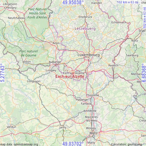
Esch-sur-Alzette GPS coordinates[2]
49° 29' 44.988" North, 5° 58' 50.016" East
| Map corner | latitude | longitude |
|---|---|---|
| Upper-left | 49.95038°, | 5.27743° |
| Center: | 49.49583°, | 5.98056° |
| Lower-right: | 49.03702°, | 6.68368° |
| Map W x H: | 101.6×101.6 km | = 63.1×63.1mi |
| max Lat: | 50.13722° ⇑96.6% North |
| Esch-sur-Alzette: | 49.49583° |
| min Lat: | ⇓3.4% South 49.45964° |
| min Long | Esch-sur-Alzett | max Long |
| 5.76583° | 5.98056° | 6.50532° |
| W 22%⇐ | ⇒78% E |
Elevation
Elevation of Esch-sur-Alzette is 295 m = 968 ft, and this is 13 m = 43 ft above average elevation for this country.
| Max E: |
502 m = 1647 ft | 41.8% |
| Esch-sur-Alzette | 295 m 968 ft | |
| Avg. | 282 m = 925 ft | |
Min E: |
143 m = 469 ft | 58.2% |
See also: Luxembourg elevation on elevation.city.
Geographical zone
Esch-sur-Alzette is located in North temperate zone (between Tropic of Cancer and the Arctic Circle). Distance of this North polar circle is 1897.8 km =1179.2 mi to North.| Distance of | km | miles | from Esch-sur-Alzette |
|---|---|---|---|
| North Pole | 4503.6 | 2798.4 | to North |
| Arctic Circle | 1897.8 | 1179.2 | to North |
| Tropic Cancer | 2897.5 | 1800.4 | to South |
| Equator | 5503.4 | 3419.7 | to South |


Nearby cities:
15 places around Esch-sur-Alzette: (largest is in red/bold)
• Belvaux
4.4 km =2.7 mi,  291°
291°
• Bergem
5.5 km =3.4 mi,  53°
53°
• Differdange
7.2 km =4.5 mi,  296°
296°
• Ehlerange
3.3 km =2.1 mi,  341°
341°
• Huncherange
6.5 km =4 mi,  68°
68°
• Kayl
4.3 km =2.7 mi,  99°
99°
• Mondercange
4.2 km =2.6 mi,  7°
7°
• Noertzange
5.7 km =3.5 mi, 74°
• Obercorn
6.4 km =4 mi, 287°
• Pontpierre
5.7 km =3.5 mi,  38°
38°
• Rumelange
5.4 km =3.4 mi,  137°
137°
• Sanem
6.9 km =4.3 mi,  327°
327°
• Schifflange
2.6 km =1.6 mi,  63°
63°
• Soleuvre
4.2 km =2.6 mi,  312°
312°
• Tétange
5 km =3.1 mi,  116°
116°
In other languages:
- In German: Esch an der Alzette, Esch-an-der-Alzette, Esch-an-der-Alzig
- In Russian: Эш-сюр-Алзетте, Эш-сюр-Альзетт
- In Chinese: 阿尔泽特河畔埃施
Sources, notices
• [Note1] Compared only with cities in Luxembourg existing in our database
• [Src1] Map data: © OpenStreetMap contributors (CC-BY-SA)
• [Src2] Other city data from geonames.org with taken over terms of usage.
• [Src3] Geographical zone / Annual Mean Temperature by Robert A. Rohde @ Wikipedia
