Tétange geodata
Tétange (Esch-sur-Alzette) is a populated place; located in Luxembourg in Europe/Luxembourg (GMT+2) time zone. With population of 2,929 people, there are 28 cities with bigger population in this country. Compared to other cities in Luxembourg, 98.9% of cities are located further ↑North; 63.8% of cities are located further →East and 63.8% of cities have lower elevation than Tétange. Note1


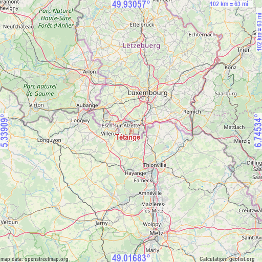
Tétange GPS coordinates[2]
49° 28' 32.988" North, 6° 2' 31.992" East
| Map corner | latitude | longitude |
|---|---|---|
| Upper-left | 49.93057°, | 5.33909° |
| Center: | 49.47583°, | 6.04222° |
| Lower-right: | 49.01683°, | 6.74534° |
| Map W x H: | 101.6×101.6 km | = 63.1×63.1mi |
| max Lat: | 50.13722° ⇑98.9% North |
| Tétange: | 49.47583° |
| min Lat: | ⇓1.1% South 49.45964° |
| min Long | Tétange | max Long |
| 5.76583° | 6.04222° | 6.50532° |
| W 36.2%⇐ | ⇒63.8% E |
Elevation
Elevation of Tétange is 300 m = 984 ft, and this is 18 m = 59 ft above average elevation for this country.
| Max E: |
502 m = 1647 ft | 36.2% |
| Tétange | 300 m 984 ft | |
| Avg. | 282 m = 925 ft | |
Min E: |
143 m = 469 ft | 63.8% |
See also: Luxembourg elevation on elevation.city.
Geographical zone
Tétange is located in North temperate zone (between Tropic of Cancer and the Arctic Circle). Distance of this North polar circle is 1900 km =1180.6 mi to North.| Distance of | km | miles | from Tétange |
|---|---|---|---|
| North Pole | 4505.9 | 2799.8 | to North |
| Arctic Circle | 1900 | 1180.6 | to North |
| Tropic Cancer | 2895.3 | 1799.1 | to South |
| Equator | 5501.2 | 3418.3 | to South |


Nearby cities:
15 places around Tétange: (largest is in red/bold)
• Bergem
5.5 km =3.4 mi,  0°
0°
• Bettembourg
6.5 km =4 mi,  42°
42°
• Dudelange
3.3 km =2.1 mi,  80°
80°
• Ehlerange
7.7 km =4.8 mi,  314°
314°
• Esch-sur-Alzette
5 km =3.1 mi,  296°
296°
• Hellange
8.5 km =5.3 mi,  65°
65°
• Huncherange
4.9 km =3 mi,  19°
19°
• Kayl
1.5 km =0.9 mi,  353°
353°
• Mondercange
7.5 km =4.7 mi,  328°
328°
• Noertzange
3.8 km =2.4 mi, 15°
• Peppange
8.3 km =5.2 mi,  49°
49°
• Pontpierre
6.8 km =4.2 mi, 352°
• Rumelange
2 km =1.2 mi,  204°
204°
• Schifflange
4 km =2.5 mi, 327°
• Soleuvre
9.1 km =5.7 mi, 303°
Sources, notices
• [Note1] Compared only with cities in Luxembourg existing in our database
• [Src1] Map data: © OpenStreetMap contributors (CC-BY-SA)
• [Src2] Other city data from geonames.org with taken over terms of usage.
• [Src3] Geographical zone / Annual Mean Temperature by Robert A. Rohde @ Wikipedia
