Viļāni geodata
Viļāni (Vilanu) is a seat of a first-order administrative division; located in Latvia in Europe/Riga (GMT+3) time zone. With population of 3,934 people, there are 42 cities with bigger population in this country. Compared to other cities in Latvia, 75% of cities are located further ↑North; 90% of cities are located further ←West and 82.9% of cities have lower elevation than Viļāni. Note1


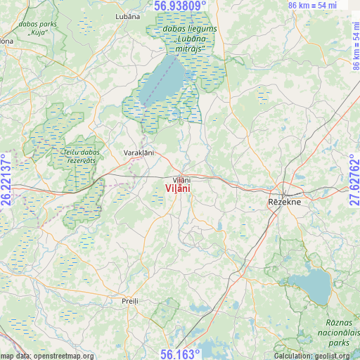
Viļāni GPS coordinates[2]
56° 33' 9.108" North, 26° 55' 28.164" East
| Map corner | latitude | longitude |
|---|---|---|
| Upper-left | 56.93809°, | 26.22137° |
| Center: | 56.55253°, | 26.92449° |
| Lower-right: | 56.163°, | 27.62762° |
| Map W x H: | 86.2×86.2 km | = 53.6×53.6mi |
| max Lat: | 57.89752° ⇑75% North |
| Viļāni: | 56.55253° |
| min Lat: | ⇓25% South 55.75284° |
| min Long | Viļāni | max Long |
| 21.01085° | 26.92449° | 28.12165° |
| W 90%⇐ | ⇒10% E |
Elevation
Elevation of Viļāni is 116 m = 381 ft, and this is 50.6 m = 166 ft above average elevation for this country.
| Max E: |
212 m = 696 ft | 17.1% |
| Viļāni | 116 m 381 ft | |
| Avg. | 65.4 m = 215 ft | |
Min E: |
2 m = 7 ft | 82.9% |
See also: Latvia elevation on elevation.city.
Geographical zone
Viļāni is located in North temperate zone (between Tropic of Cancer and the Arctic Circle). Distance of this North polar circle is 1113.1 km =691.6 mi to North.| Distance of | km | miles | from Viļāni |
|---|---|---|---|
| North Pole | 3719 | 2310.9 | to North |
| Arctic Circle | 1113.1 | 691.6 | to North |
| Tropic Cancer | 3682.1 | 2288 | to South |
| Equator | 6288.1 | 3907.2 | to South |


Nearby cities:
15 places around Viļāni: (largest is in red/bold)
• Aglona
47 km =29.2 mi,  173°
173°
• Cesvaine
59.5 km =37 mi,  320°
320°
• Cibla
58.8 km =36.5 mi,  90°
90°
• Jaunaglona
43.9 km =27.3 mi, 173°
• Kārsava
53.3 km =33.1 mi,  61°
61°
• Lubāna
41.1 km =25.5 mi,  341°
341°
• Ludza
48.7 km =30.3 mi, 91°
• Līvāni
51 km =31.7 mi,  244°
244°
• Madona
54.6 km =33.9 mi,  307°
307°
• Preiļi
31.2 km =19.4 mi,  203°
203°
• Riebiņi
24.5 km =15.2 mi, 198°
• Rugāji
51.7 km =32.1 mi,  14°
14°
• Rēzekne
25.9 km =16.1 mi,  100°
100°
• Varakļāni
12.2 km =7.6 mi,  300°
300°
• Vecvārkava
47 km =29.2 mi,  213°
213°
Sources, notices
• [Note1] Compared only with cities in Latvia existing in our database
• [Src1] Map data: © OpenStreetMap contributors (CC-BY-SA)
• [Src2] Other city data from geonames.org with taken over terms of usage.
• [Src3] Geographical zone / Annual Mean Temperature by Robert A. Rohde @ Wikipedia
