Vecpiebalga geodata
Vecpiebalga is a seat of a first-order administrative division; located in Latvia in Europe/Riga (GMT+3) time zone. With population of 596 people, there are 108 cities with bigger population in this country. Compared to other cities in Latvia, 67.1% of cities are located further ↓South; 75.7% of cities are located further ←West and 100% of cities have lower elevation than Vecpiebalga. Note1


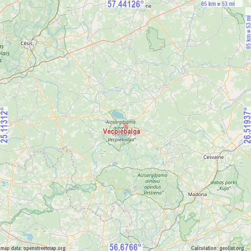
Vecpiebalga GPS coordinates[2]
57° 3' 39.24" North, 25° 48' 58.464" East
| Map corner | latitude | longitude |
|---|---|---|
| Upper-left | 57.44126°, | 25.11312° |
| Center: | 57.0609°, | 25.81624° |
| Lower-right: | 56.6766°, | 26.51937° |
| Map W x H: | 85×85 km | = 52.8×52.8mi |
| max Lat: | 57.89752° ⇑32.9% North |
| Vecpiebalga: | 57.0609° |
| min Lat: | ⇓67.1% South 55.75284° |
| min Long | Vecpiebalga | max Long |
| 21.01085° | 25.81624° | 28.12165° |
| W 75.7%⇐ | ⇒24.3% E |
Elevation
Elevation of Vecpiebalga is 212 m = 696 ft, and this is 146.6 m = 481 ft above average elevation for this country.
| Max E: |
212 m = 696 ft | 0% |
| Vecpiebalga | 212 m 696 ft | |
| Avg. | 65.4 m = 215 ft | |
Min E: |
2 m = 7 ft | 100% |
See also: Latvia elevation on elevation.city.
Geographical zone
Vecpiebalga is located in North temperate zone (between Tropic of Cancer and the Arctic Circle). Distance of this North polar circle is 1056.6 km =656.5 mi to North.| Distance of | km | miles | from Vecpiebalga |
|---|---|---|---|
| North Pole | 3662.5 | 2275.8 | to North |
| Arctic Circle | 1056.6 | 656.5 | to North |
| Tropic Cancer | 3738.7 | 2323.1 | to South |
| Equator | 6344.6 | 3942.4 | to South |


Nearby cities:
15 places around Vecpiebalga: (largest is in red/bold)
• Cesvaine
31.5 km =19.6 mi,  109°
109°
• Cēsis
42.9 km =26.7 mi,  310°
310°
• Drabeši
38.3 km =23.8 mi,  301°
301°
• Jaunpiebalga
18.2 km =11.3 mi,  44°
44°
• Koknese
51 km =31.7 mi,  206°
206°
• Lubāna
57.2 km =35.5 mi, 107°
• Līgatne
50.6 km =31.4 mi,  292°
292°
• Madona
33.5 km =20.8 mi,  133°
133°
• Mālpils
52.2 km =32.4 mi,  263°
263°
• Mūrmuiža
49.8 km =30.9 mi,  336°
336°
• Priekuļi
39.4 km =24.5 mi,  315°
315°
• Pļaviņas
49.6 km =30.8 mi,  186°
186°
• Rauna
32.6 km =20.3 mi, 337°
• Smiltene
40.7 km =25.3 mi,  7°
7°
• Ērgļi
21.2 km =13.2 mi, 210°
Sources, notices
• [Note1] Compared only with cities in Latvia existing in our database
• [Src1] Map data: © OpenStreetMap contributors (CC-BY-SA)
• [Src2] Other city data from geonames.org with taken over terms of usage.
• [Src3] Geographical zone / Annual Mean Temperature by Robert A. Rohde @ Wikipedia
