Pļaviņas geodata
Pļaviņas (Pļaviņu) is a seat of a first-order administrative division; located in Latvia in Europe/Riga (GMT+3) time zone. With population of 3,848 people, there are 44 cities with bigger population in this country. Compared to other cities in Latvia, 70% of cities are located further ↑North; 72.9% of cities are located further ←West and 59.3% of cities have lower elevation than Pļaviņas. Note1


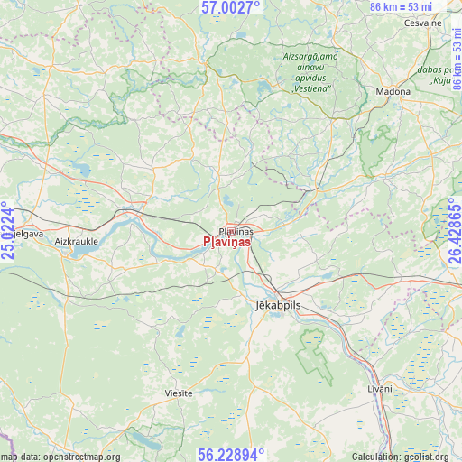
Pļaviņas GPS coordinates[2]
56° 37' 4.08" North, 25° 43' 31.872" East
| Map corner | latitude | longitude |
|---|---|---|
| Upper-left | 57.0027°, | 25.0224° |
| Center: | 56.6178°, | 25.72552° |
| Lower-right: | 56.22894°, | 26.42865° |
| Map W x H: | 86×86 km | = 53.4×53.4mi |
| max Lat: | 57.89752° ⇑70% North |
| Pļaviņas: | 56.6178° |
| min Lat: | ⇓30% South 55.75284° |
| min Long | Pļaviņas | max Long |
| 21.01085° | 25.72552° | 28.12165° |
| W 72.9%⇐ | ⇒27.1% E |
Elevation
Elevation of Pļaviņas is 75 m = 246 ft, and this is 9.6 m = 31 ft above average elevation for this country.
| Max E: |
212 m = 696 ft | 40.7% |
| Pļaviņas | 75 m 246 ft | |
| Avg. | 65.4 m = 215 ft | |
Min E: |
2 m = 7 ft | 59.3% |
See also: Latvia elevation on elevation.city.
Geographical zone
Pļaviņas is located in North temperate zone (between Tropic of Cancer and the Arctic Circle). Distance of this North polar circle is 1105.9 km =687.2 mi to North.| Distance of | km | miles | from Pļaviņas |
|---|---|---|---|
| North Pole | 3711.8 | 2306.4 | to North |
| Arctic Circle | 1105.9 | 687.2 | to North |
| Tropic Cancer | 3689.4 | 2292.5 | to South |
| Equator | 6295.3 | 3911.7 | to South |


Nearby cities:
15 places around Pļaviņas: (largest is in red/bold)
• Aizkraukle
28.8 km =17.9 mi,  267°
267°
• Aknīste
50.8 km =31.6 mi,  178°
178°
• Cesvaine
52.6 km =32.7 mi,  42°
42°
• Jaunjelgava
39.3 km =24.4 mi, 269°
• Jumprava
46.5 km =28.9 mi,  278°
278°
• Jēkabpils
15.5 km =9.6 mi,  148°
148°
• Koknese
18.1 km =11.2 mi, 282°
• Krustpils
14.5 km =9 mi, 145°
• Līvāni
40.3 km =25 mi,  136°
136°
• Madona
39.8 km =24.7 mi,  48°
48°
• Sala
12.6 km =7.8 mi,  169°
169°
• Skrīveri
37.1 km =23.1 mi, 274°
• Vecpiebalga
49.6 km =30.8 mi,  6°
6°
• Viesīte
31.8 km =19.8 mi,  199°
199°
• Ērgļi
31.6 km =19.6 mi,  350°
350°
Sources, notices
• [Note1] Compared only with cities in Latvia existing in our database
• [Src1] Map data: © OpenStreetMap contributors (CC-BY-SA)
• [Src2] Other city data from geonames.org with taken over terms of usage.
• [Src3] Geographical zone / Annual Mean Temperature by Robert A. Rohde @ Wikipedia
