Drabeši geodata
Drabeši (Amatas) is a seat of a first-order administrative division; located in Latvia in Europe/Riga (GMT+3) time zone. In our database, there are 110 cities with bigger population. Compared to other cities in Latvia, 79.3% of cities are located further ↓South; 63.6% of cities are located further ←West and 91.4% of cities have lower elevation than Drabeši. Note1


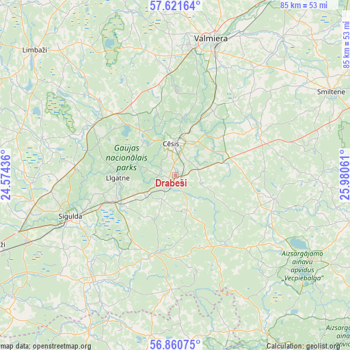
Drabeši GPS coordinates[2]
57° 14' 35.376" North, 25° 16' 38.928" East
| Map corner | latitude | longitude |
|---|---|---|
| Upper-left | 57.62164°, | 24.57436° |
| Center: | 57.24316°, | 25.27748° |
| Lower-right: | 56.86075°, | 25.98061° |
| Map W x H: | 84.6×84.6 km | = 52.6×52.6mi |
| max Lat: | 57.89752° ⇑20.7% North |
| Drabeši: | 57.24316° |
| min Lat: | ⇓79.3% South 55.75284° |
| min Long | Drabeši | max Long |
| 21.01085° | 25.27748° | 28.12165° |
| W 63.6%⇐ | ⇒36.4% E |
Elevation
Elevation of Drabeši is 147 m = 482 ft, and this is 81.6 m = 268 ft above average elevation for this country.
| Max E: |
212 m = 696 ft | 8.6% |
| Drabeši | 147 m 482 ft | |
| Avg. | 65.4 m = 215 ft | |
Min E: |
2 m = 7 ft | 91.4% |
See also: Latvia elevation on elevation.city.
Geographical zone
Drabeši is located in North temperate zone (between Tropic of Cancer and the Arctic Circle). Distance of this North polar circle is 1036.3 km =643.9 mi to North.| Distance of | km | miles | from Drabeši |
|---|---|---|---|
| North Pole | 3642.2 | 2263.2 | to North |
| Arctic Circle | 1036.3 | 643.9 | to North |
| Tropic Cancer | 3758.9 | 2335.7 | to South |
| Equator | 6364.8 | 3954.9 | to South |


Nearby cities:
15 places around Drabeši: (largest is in red/bold)
• Cēsis
7.6 km =4.7 mi,  358°
358°
• Inčukalns
39.1 km =24.3 mi,  245°
245°
• Kocēni
31.1 km =19.3 mi,  6°
6°
• Loja
39.5 km =24.5 mi,  255°
255°
• Līgatne
14.3 km =8.9 mi,  266°
266°
• Mālpils
32.3 km =20.1 mi,  216°
216°
• Mūrmuiža
28.6 km =17.8 mi,  26°
26°
• Priekuļi
9.4 km =5.8 mi, 32°
• Ragana
35 km =21.7 mi, 258°
• Rauna
22.2 km =13.8 mi,  63°
63°
• Sigulda
27.1 km =16.8 mi, 248°
• Smiltene
42.5 km =26.4 mi, 61°
• Stalbe
20.5 km =12.7 mi,  313°
313°
• Valmiera
34.3 km =21.3 mi,  15°
15°
• Vecpiebalga
38.3 km =23.8 mi,  121°
121°
Sources, notices
• [Note1] Compared only with cities in Latvia existing in our database
• [Src1] Map data: © OpenStreetMap contributors (CC-BY-SA)
• [Src2] Other city data from geonames.org with taken over terms of usage.
• [Src3] Geographical zone / Annual Mean Temperature by Robert A. Rohde @ Wikipedia
