Oued Laou geodata
Oued Laou (Tanger-Tetouan-Al Hoceima) is a seat of a third-order administrative division; located in Morocco in Africa/Casablanca (GMT+1) time zone. In our database, there are 108 cities with bigger population. Compared to other cities in Morocco, 95.7% of cities are located further ↓South; 71.3% of cities are located further ←West and 92.2% of cities have higher elevation than Oued Laou. Note1


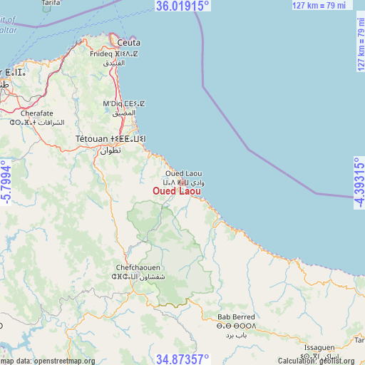
Oued Laou GPS coordinates[2]
35° 26' 54.24" North, 5° 5' 46.572" West
| Map corner | latitude | longitude |
|---|---|---|
| Upper-left | 36.01915°, | -5.7994° |
| Center: | 35.4484°, | -5.09627° |
| Lower-right: | 34.87357°, | -4.39315° |
| Map W x H: | 127.4×127.4 km | = 79.2×79.2mi |
| max Lat: | 35.84906° ⇑4.3% North |
| Oued Laou: | 35.4484° |
| min Lat: | ⇓95.7% South 22.6558° |
| min Long | Oued Laou | max Long |
| -15.60719° | -5.09627° | -1.22855° |
| W 71.3%⇐ | ⇒28.7% E |
Elevation
Elevation of Oued Laou is 20 m = 66 ft, and this is 596.8 m = 1958 ft below average elevation for this country.
| Max E: |
2637 m = 8652 ft | 92.2% |
| Avg. | 616.8 m = 2024 ft | |
| Oued Laou | 20 m = 66 ft | |
Min E: |
1 m = 3 ft | 7.8% |
See also: Morocco elevation on elevation.city.
Geographical zone
Oued Laou is located in North temperate zone (between Tropic of Cancer and the Arctic Circle). Distance of this Northern Tropic circle is 1335.6 km =829.9 mi to South.| Distance of | km | miles | from Oued Laou |
|---|---|---|---|
| North Pole | 6065.6 | 3769 | to North |
| Arctic Circle | 3459.7 | 2149.8 | to North |
| Tropic Cancer | 1335.6 | 829.9 | to South |
| Equator | 3941.5 | 2449.1 | to South |


Nearby cities:
15 places around Oued Laou: (largest is in red/bold)
• Azla
17.8 km =11.1 mi,  310°
310°
• Bab Taza
44 km =27.3 mi,  192°
192°
• Cap Negro II
29.1 km =18.1 mi,  323°
323°
• Chefchaouene
34.6 km =21.5 mi,  206°
206°
• Dar Chaoui
57.1 km =35.5 mi,  280°
280°
• Derdara
41.5 km =25.8 mi, 205°
• Fifi
57.2 km =35.5 mi, 193°
• Fnidek
50.4 km =31.3 mi,  332°
332°
• Mahroun
46.7 km =29 mi,  195°
195°
• Martil
24.7 km =15.3 mi, 319°
• Mdiq
33.5 km =20.8 mi, 321°
• Saddina
37.1 km =23.1 mi,  299°
299°
• Tizgane
4.8 km =3 mi,  147°
147°
• Tétouan
28.6 km =17.8 mi, 300°
• Zinat
27.6 km =17.1 mi,  265°
265°
Sources, notices
• [Note1] Compared only with cities in Morocco existing in our database
• [Src1] Map data: © OpenStreetMap contributors (CC-BY-SA)
• [Src2] Other city data from geonames.org with taken over terms of usage.
• [Src3] Geographical zone / Annual Mean Temperature by Robert A. Rohde @ Wikipedia
