Tizgane geodata
Tizgane (Tanger-Tetouan-Al Hoceima) is a seat of a third-order administrative division; located in Morocco in Africa/Casablanca (GMT+1) time zone. In our database, there are 108 cities with bigger population. Compared to other cities in Morocco, 95% of cities are located further ↓South; 71.7% of cities are located further ←West and 97.3% of cities have higher elevation than Tizgane. Note1
Administrative division(s):
- Level 1: Tanger-Tetouan-Al Hoceima
- Level 2: Chefchaouen Province
- Level 3: Tizgane


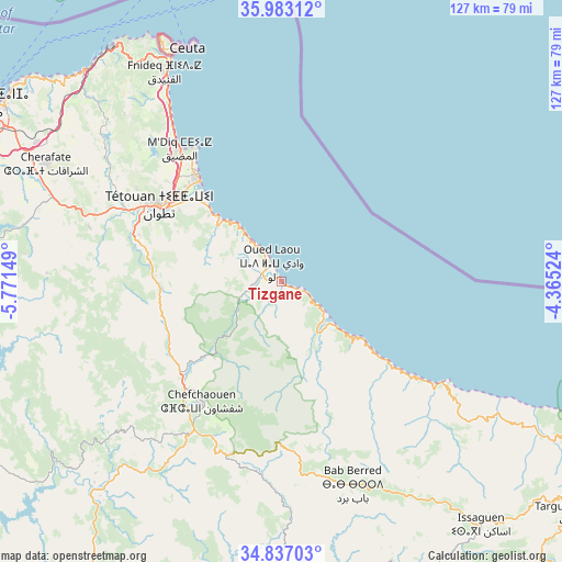
Tizgane GPS coordinates[2]
35° 24' 43.596" North, 5° 4' 6.096" West
| Map corner | latitude | longitude |
|---|---|---|
| Upper-left | 35.98312°, | -5.77149° |
| Center: | 35.41211°, | -5.06836° |
| Lower-right: | 34.83703°, | -4.36524° |
| Map W x H: | 127.4×127.4 km | = 79.2×79.2mi |
| max Lat: | 35.84906° ⇑5% North |
| Tizgane: | 35.41211° |
| min Lat: | ⇓95% South 22.6558° |
| min Long | Tizgane | max Long |
| -15.60719° | -5.06836° | -1.22855° |
| W 71.7%⇐ | ⇒28.3% E |
Elevation
Elevation of Tizgane is 9 m = 30 ft, and this is 607.8 m = 1994 ft below average elevation for this country.
| Max E: |
2637 m = 8652 ft | 97.3% |
| Avg. | 616.8 m = 2024 ft | |
| Tizgane | 9 m = 30 ft | |
Min E: |
1 m = 3 ft | 2.7% |
See also: Morocco elevation on elevation.city.
Geographical zone
Tizgane is located in North temperate zone (between Tropic of Cancer and the Arctic Circle). Distance of this Northern Tropic circle is 1331.5 km =827.4 mi to South.| Distance of | km | miles | from Tizgane |
|---|---|---|---|
| North Pole | 6069.6 | 3771.5 | to North |
| Arctic Circle | 3463.7 | 2152.2 | to North |
| Tropic Cancer | 1331.5 | 827.4 | to South |
| Equator | 3937.5 | 2446.6 | to South |


Nearby cities:
15 places around Tizgane: (largest is in red/bold)
• Azla
22.4 km =13.9 mi,  314°
314°
• Bab Taza
40.7 km =25.3 mi,  196°
196°
• Cap Negro II
33.8 km =21 mi,  324°
324°
• Chefchaouene
32.3 km =20.1 mi,  213°
213°
• Derdara
39.1 km =24.3 mi, 210°
• Fifi
54 km =33.6 mi, 197°
• Fnidek
55.2 km =34.3 mi,  331°
331°
• Mahroun
43.7 km =27.2 mi, 200°
• Martil
29.5 km =18.3 mi, 320°
• Mdiq
38.2 km =23.7 mi, 321°
• Oued Laou
4.8 km =3 mi, 327°
• Saddina
41.3 km =25.7 mi,  302°
302°
• Tamorot
59.1 km =36.7 mi,  153°
153°
• Tétouan
32.9 km =20.4 mi, 304°
• Zinat
30.1 km =18.7 mi,  273°
273°
Sources, notices
• [Note1] Compared only with cities in Morocco existing in our database
• [Src1] Map data: © OpenStreetMap contributors (CC-BY-SA)
• [Src2] Other city data from geonames.org with taken over terms of usage.
• [Src3] Geographical zone / Annual Mean Temperature by Robert A. Rohde @ Wikipedia
