Fifi geodata
Fifi (Tanger-Tetouan-Al Hoceima) is a seat of a third-order administrative division; located in Morocco in Africa/Casablanca (GMT+1) time zone. In our database, there are 108 cities with bigger population. Compared to other cities in Morocco, 85.7% of cities are located further ↓South; 65.9% of cities are located further ←West and 55.8% of cities have lower elevation than Fifi. Note1
Administrative division(s):
- Level 1: Tanger-Tetouan-Al Hoceima
- Level 2: Chefchaouen Province
- Level 3: Fifi


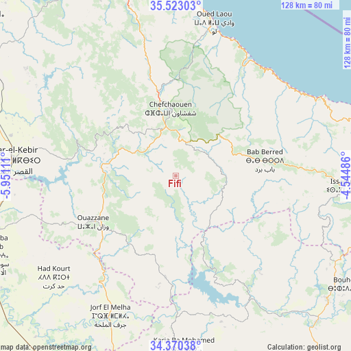
Fifi GPS coordinates[2]
34° 56' 55.428" North, 5° 14' 52.728" West
| Map corner | latitude | longitude |
|---|---|---|
| Upper-left | 35.52303°, | -5.95111° |
| Center: | 34.94873°, | -5.24798° |
| Lower-right: | 34.37038°, | -4.54486° |
| Map W x H: | 128.2×128.2 km | = 79.7×79.7mi |
| max Lat: | 35.84906° ⇑14.3% North |
| Fifi: | 34.94873° |
| min Lat: | ⇓85.7% South 22.6558° |
| min Long | Fifi | max Long |
| -15.60719° | -5.24798° | -1.22855° |
| W 65.9%⇐ | ⇒34.1% E |
Elevation
Elevation of Fifi is 579 m = 1900 ft, and this is 37.8 m = 124 ft below average elevation for this country.
| Max E: |
2637 m = 8652 ft | 44.2% |
| Avg. | 616.8 m = 2024 ft | |
| Fifi | 579 m = 1900 ft | |
Min E: |
1 m = 3 ft | 55.8% |
See also: Morocco elevation on elevation.city.
Geographical zone
Fifi is located in North temperate zone (between Tropic of Cancer and the Arctic Circle). Distance of this Northern Tropic circle is 1280 km =795.4 mi to South.| Distance of | km | miles | from Fifi |
|---|---|---|---|
| North Pole | 6121.1 | 3803.5 | to North |
| Arctic Circle | 3515.2 | 2184.2 | to North |
| Tropic Cancer | 1280 | 795.4 | to South |
| Equator | 3885.9 | 2414.6 | to South |


Nearby cities:
15 places around Fifi: (largest is in red/bold)
• Bab Taza
13.3 km =8.3 mi,  19°
19°
• Brikcha
29.7 km =18.5 mi,  273°
273°
• Chefchaouene
24.5 km =15.2 mi,  356°
356°
• Derdara
18.4 km =11.4 mi,  347°
347°
• Mahroun
10.6 km =6.6 mi,  6°
6°
• Moulay Bouchta
52.2 km =32.4 mi,  168°
168°
• Ouezzane
34.6 km =21.5 mi,  240°
240°
• Ourtzagh
52.6 km =32.7 mi,  151°
151°
• Ratba
33.9 km =21.1 mi,  124°
124°
• Sidi Bousber
44.2 km =27.5 mi,  193°
193°
• Sidi Redouane
34.2 km =21.3 mi,  211°
211°
• Tabouda
27.3 km =17 mi,  158°
158°
• Tamorot
42.7 km =26.5 mi,  91°
91°
• Teroual
30.6 km =19 mi,  184°
184°
• Zoumi
18.4 km =11.4 mi, 208°
Sources, notices
• [Note1] Compared only with cities in Morocco existing in our database
• [Src1] Map data: © OpenStreetMap contributors (CC-BY-SA)
• [Src2] Other city data from geonames.org with taken over terms of usage.
• [Src3] Geographical zone / Annual Mean Temperature by Robert A. Rohde @ Wikipedia
