Boulemane geodata
Boulemane (Fès-Meknès) is a seat of a third-order administrative division; located in Morocco in Africa/Casablanca (GMT+1) time zone. In our database, there are 108 cities with bigger population. Compared to other cities in Morocco, 54.3% of cities are located further ↓South; 78.3% of cities are located further ←West and 96.9% of cities have lower elevation than Boulemane. Note1


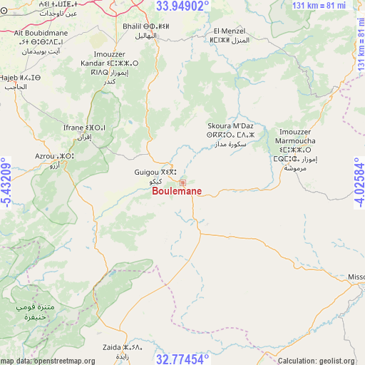
Boulemane GPS coordinates[2]
33° 21' 49.536" North, 4° 43' 44.256" West
| Map corner | latitude | longitude |
|---|---|---|
| Upper-left | 33.94902°, | -5.43209° |
| Center: | 33.36376°, | -4.72896° |
| Lower-right: | 32.77454°, | -4.02584° |
| Map W x H: | 130.6×130.6 km | = 81.2×81.2mi |
| max Lat: | 35.84906° ⇑45.7% North |
| Boulemane: | 33.36376° |
| min Lat: | ⇓54.3% South 22.6558° |
| min Long | Boulemane | max Long |
| -15.60719° | -4.72896° | -1.22855° |
| W 78.3%⇐ | ⇒21.7% E |
Elevation
Elevation of Boulemane is 1712 m = 5617 ft, and this is 1095.2 m = 3593 ft above average elevation for this country.
| Max E: |
2637 m = 8652 ft | 3.1% |
| Boulemane | 1712 m 5617 ft | |
| Avg. | 616.8 m = 2024 ft | |
Min E: |
1 m = 3 ft | 96.9% |
See also: Morocco elevation on elevation.city.
Geographical zone
Boulemane is located in North temperate zone (between Tropic of Cancer and the Arctic Circle). Distance of this Northern Tropic circle is 1103.8 km =685.9 mi to South.| Distance of | km | miles | from Boulemane |
|---|---|---|---|
| North Pole | 6297.4 | 3913 | to North |
| Arctic Circle | 3691.5 | 2293.8 | to North |
| Tropic Cancer | 1103.8 | 685.9 | to South |
| Equator | 3709.7 | 2305.1 | to South |


Nearby cities:
15 places around Boulemane: (largest is in red/bold)
• Almis Marmoucha
51.2 km =31.8 mi,  95°
95°
• Amersid
72.4 km =45 mi,  160°
160°
• Azrou
46.4 km =28.8 mi,  279°
279°
• Aïn Leuh
57.2 km =35.5 mi,  261°
261°
• Bhalil
55.9 km =34.7 mi,  346°
346°
• El Hajeb
69.6 km =43.2 mi,  301°
301°
• Ifrane
39.7 km =24.7 mi, 297°
• Itzer
61.8 km =38.4 mi,  209°
209°
• Midelt
75.5 km =46.9 mi,  181°
181°
• Oulad Tayeb
69.3 km =43.1 mi,  339°
339°
• Sefrou
52.8 km =32.8 mi, 350°
• Sidi Harazem
75.2 km =46.7 mi, 349°
• Talzemt
56 km =34.8 mi,  63°
63°
• Tazarine
76.5 km =47.5 mi,  41°
41°
• Tazouta
35.2 km =21.9 mi,  14°
14°
Sources, notices
• [Note1] Compared only with cities in Morocco existing in our database
• [Src1] Map data: © OpenStreetMap contributors (CC-BY-SA)
• [Src2] Other city data from geonames.org with taken over terms of usage.
• [Src3] Geographical zone / Annual Mean Temperature by Robert A. Rohde @ Wikipedia
