Tazarine geodata
Tazarine (Fès-Meknès) is a seat of a third-order administrative division; located in Morocco in Africa/Casablanca (GMT+1) time zone. In our database, there are 108 cities with bigger population. Compared to other cities in Morocco, 62% of cities are located further ↓South; 84.9% of cities are located further ←West and 89.1% of cities have lower elevation than Tazarine. Note1


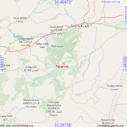
Tazarine GPS coordinates[2]
33° 52' 59.052" North, 4° 11' 10.32" West
| Map corner | latitude | longitude |
|---|---|---|
| Upper-left | 34.46479°, | -4.88933° |
| Center: | 33.88307°, | -4.1862° |
| Lower-right: | 33.29736°, | -3.48308° |
| Map W x H: | 129.8×129.8 km | = 80.7×80.7mi |
| max Lat: | 35.84906° ⇑38% North |
| Tazarine: | 33.88307° |
| min Lat: | ⇓62% South 22.6558° |
| min Long | Tazarine | max Long |
| -15.60719° | -4.1862° | -1.22855° |
| W 84.9%⇐ | ⇒15.1% E |
Elevation
Elevation of Tazarine is 1370 m = 4495 ft, and this is 753.2 m = 2471 ft above average elevation for this country.
| Max E: |
2637 m = 8652 ft | 10.9% |
| Tazarine | 1370 m 4495 ft | |
| Avg. | 616.8 m = 2024 ft | |
Min E: |
1 m = 3 ft | 89.1% |
See also: Morocco elevation on elevation.city.
Geographical zone
Tazarine is located in North temperate zone (between Tropic of Cancer and the Arctic Circle). Distance of this Northern Tropic circle is 1161.5 km =721.7 mi to South.| Distance of | km | miles | from Tazarine |
|---|---|---|---|
| North Pole | 6239.6 | 3877.1 | to North |
| Arctic Circle | 3633.7 | 2257.9 | to North |
| Tropic Cancer | 1161.5 | 721.7 | to South |
| Equator | 3767.4 | 2341 | to South |


Nearby cities:
15 places around Tazarine: (largest is in red/bold)
• Almis Marmoucha
62.6 km =38.9 mi,  179°
179°
• Bhalil
63.4 km =39.4 mi,  266°
266°
• Fès al Bali
73.9 km =45.9 mi,  286°
286°
• Matmata
41.4 km =25.7 mi,  305°
305°
• Oued Amlil
36.3 km =22.6 mi,  346°
346°
• Oulad Daoud
74.4 km =46.2 mi,  321°
321°
• Oulad Tayeb
75 km =46.6 mi,  275°
275°
• Sefrou
59.5 km =37 mi,  264°
264°
• Sidi Harazem
66.3 km =41.2 mi, 284°
• Tahla
28.5 km =17.7 mi, 310°
• Talzemt
32.6 km =20.3 mi, 180°
• Taza
39.8 km =24.7 mi,  24°
24°
• Tazouta
47.7 km =29.6 mi,  240°
240°
• Tissa
62.9 km =39.1 mi, 315°
• Tmourghout
14.9 km =9.3 mi,  79°
79°
Sources, notices
• [Note1] Compared only with cities in Morocco existing in our database
• [Src1] Map data: © OpenStreetMap contributors (CC-BY-SA)
• [Src2] Other city data from geonames.org with taken over terms of usage.
• [Src3] Geographical zone / Annual Mean Temperature by Robert A. Rohde @ Wikipedia
