Antsohihy geodata
Antsohihy (Sofia) is a seat of a first-order administrative division; located in Madagascar in Indian/Antananarivo (GMT+3) time zone. With population of 21,290 people, there are 59 cities with bigger population in this country. Compared to other cities in Madagascar, 89.4% of cities are located further ↓South; 67.5% of cities are located further ←West and 78.9% of cities have higher elevation than Antsohihy. Note1


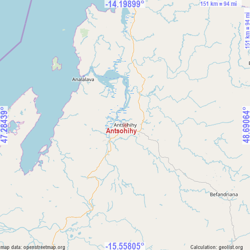
Antsohihy GPS coordinates[2]
14° 52' 46.524" South, 47° 59' 15.036" East
| Map corner | latitude | longitude |
|---|---|---|
| Upper-left | -14.19899°, | 47.28439° |
| Center: | -14.87959°, | 47.98751° |
| Lower-right: | -15.55805°, | 48.69064° |
| Map W x H: | 151.1×151.1 km | = 93.9×93.9mi |
| max Lat: | -12.31732° ⇑10.6% North |
| Antsohihy: | -14.87959° |
| min Lat: | ⇓89.4% South -25.3° |
| min Long | Antsohihy | max Long |
| 43.65° | 47.98751° | 50.27876° |
| W 67.5%⇐ | ⇒32.5% E |
Elevation
Elevation of Antsohihy is 18 m = 59 ft, and this is 539.4 m = 1770 ft below average elevation for this country.
| Max E: |
1763 m = 5784 ft | 78.9% |
| Avg. | 557.4 m = 1829 ft | |
| Antsohihy | 18 m = 59 ft | |
Min E: |
1 m = 3 ft | 21.1% |
See also: Madagascar elevation on elevation.city.
Geographical zone
Antsohihy is located in South Torrid zone (between Equator and Tropic of Capricorn). Distance of this Southern Tropic circle is 951.5 km =591.2 mi to South.| Distance of | km | miles | from Antsohihy |
|---|---|---|---|
| Equator | 1654.5 | 1028.1 | to North |
| Tropic Capricorn | 951.5 | 591.2 | to South |
| Antarctic Circle | 5746.7 | 3570.8 | to South |
| South Pole | 8352.6 | 5190.1 | to South |


Nearby cities:
15 places around Antsohihy: (largest is in red/bold)
• Ambanja
143.6 km =89.2 mi,  20°
20°
• Ambarakaraka
180.3 km =112 mi,  31°
31°
• Ambato Boeny
222.8 km =138.4 mi,  217°
217°
• Ambilobe
219.1 km =136.1 mi, 31°
• Andapa
180.6 km =112.2 mi,  81°
81°
• Antakotako
200.5 km =124.6 mi,  104°
104°
• Antsirabe Afovoany
158.7 km =98.6 mi,  138°
138°
• Antsohimbondrona
220.3 km =136.9 mi, 24°
• Bealanana
90.1 km =56 mi,  65°
65°
• Hell-Ville
167.6 km =104.1 mi,  10°
10°
• Mahajanga
201.9 km =125.5 mi,  242°
242°
• Mandritsara
141.2 km =87.7 mi, 140°
• Maroantsetra
197.8 km =122.9 mi,  108°
108°
• Marovoay
198.7 km =123.5 mi,  226°
226°
• Tsaratanana
216.2 km =134.3 mi,  189°
189°
Sources, notices
• [Note1] Compared only with cities in Madagascar existing in our database
• [Src1] Map data: © OpenStreetMap contributors (CC-BY-SA)
• [Src2] Other city data from geonames.org with taken over terms of usage.
• [Src3] Geographical zone / Annual Mean Temperature by Robert A. Rohde @ Wikipedia
