Ambato Boeny geodata
Ambato Boeny (Boeny) is a populated place; located in Madagascar in Indian/Antananarivo (GMT+3) time zone. With population of 22,529 people, there are 56 cities with bigger population in this country. Compared to other cities in Madagascar, 82.1% of cities are located further ↓South; 74% of cities are located further →East and 70.7% of cities have higher elevation than Ambato Boeny. Note1
Administrative division(s):
- Level 1: Boeny
- Level 2: Ambato Boeni
- Level 3: Ambato Ambarimay
- Level 4: Ambato Boeny


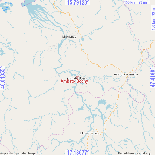
Ambato Boeny GPS coordinates[2]
16° 28' 0.012" South, 46° 43' 0.012" East
| Map corner | latitude | longitude |
|---|---|---|
| Upper-left | -15.79123°, | 46.01355° |
| Center: | -16.46667°, | 46.71667° |
| Lower-right: | -17.13977°, | 47.4198° |
| Map W x H: | 149.9×149.9 km | = 93.1×93.1mi |
| max Lat: | -12.31732° ⇑17.9% North |
| Ambato Boeny: | -16.46667° |
| min Lat: | ⇓82.1% South -25.3° |
| min Long | Ambato Boeny | max Long |
| 43.65° | 46.71667° | 50.27876° |
| W 26%⇐ | ⇒74% E |
Elevation
Elevation of Ambato Boeny is 36 m = 118 ft, and this is 521.4 m = 1711 ft below average elevation for this country.
| Max E: |
1763 m = 5784 ft | 70.7% |
| Avg. | 557.4 m = 1829 ft | |
| Ambato Boeny | 36 m = 118 ft | |
Min E: |
1 m = 3 ft | 29.3% |
See also: Madagascar elevation on elevation.city.
Geographical zone
Ambato Boeny is located in South Torrid zone (between Equator and Tropic of Capricorn). Distance of this Southern Tropic circle is 775 km =481.6 mi to South.| Distance of | km | miles | from Ambato Boeny |
|---|---|---|---|
| Equator | 1830.9 | 1137.7 | to North |
| Tropic Capricorn | 775 | 481.6 | to South |
| Antarctic Circle | 5570.3 | 3461.2 | to South |
| South Pole | 8176.1 | 5080.4 | to South |


Nearby cities:
15 places around Ambato Boeny: (largest is in red/bold)
• Ambatondrazaka
236 km =146.6 mi,  130°
130°
• Amparafaravola
203 km =126.1 mi, 127°
• Andilamena
206.7 km =128.4 mi,  106°
106°
• Ankazobe
210 km =130.5 mi,  168°
168°
• Antsirabe Afovoany
247 km =153.5 mi,  76°
76°
• Antsohihy
222.8 km =138.4 mi,  37°
37°
• Bemaitso
201.2 km =125 mi, 109°
• Fenoarivo Be
219.3 km =136.3 mi,  184°
184°
• Maevatanana
55.2 km =34.3 mi, 166°
• Mahabe
162.4 km =100.9 mi,  245°
245°
• Mahajanga
93.7 km =58.2 mi,  332°
332°
• Mandritsara
235.5 km =146.3 mi,  73°
73°
• Marovoay
40.3 km =25 mi,  348°
348°
• Sitampiky
69.4 km =43.1 mi, 251°
• Tsaratanana
106.2 km =66 mi, 110°
Sources, notices
• [Note1] Compared only with cities in Madagascar existing in our database
• [Src1] Map data: © OpenStreetMap contributors (CC-BY-SA)
• [Src2] Other city data from geonames.org with taken over terms of usage.
• [Src3] Geographical zone / Annual Mean Temperature by Robert A. Rohde @ Wikipedia
