Mahabe geodata
Mahabe (Melaky) is a populated place; located in Madagascar in Indian/Antananarivo (GMT+3) time zone. With population of 10,000 people, there are 91 cities with bigger population in this country. Compared to other cities in Madagascar, 75.6% of cities are located further ↓South; 86.2% of cities are located further →East and 52.8% of cities have lower elevation than Mahabe. Note1


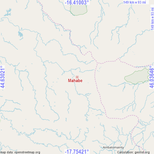
Mahabe GPS coordinates[2]
17° 4' 59.988" South, 45° 19' 59.988" East
| Map corner | latitude | longitude |
|---|---|---|
| Upper-left | -16.41003°, | 44.63021° |
| Center: | -17.08333°, | 45.33333° |
| Lower-right: | -17.75421°, | 46.03646° |
| Map W x H: | 149.5×149.5 km | = 92.9×92.9mi |
| max Lat: | -12.31732° ⇑24.4% North |
| Mahabe: | -17.08333° |
| min Lat: | ⇓75.6% South -25.3° |
| min Long | Mahabe | max Long |
| 43.65° | 45.33333° | 50.27876° |
| W 13.8%⇐ | ⇒86.2% E |
Elevation
Elevation of Mahabe is 293 m = 961 ft, and this is 264.4 m = 867 ft below average elevation for this country.
| Max E: |
1763 m = 5784 ft | 47.2% |
| Avg. | 557.4 m = 1829 ft | |
| Mahabe | 293 m = 961 ft | |
Min E: |
1 m = 3 ft | 52.8% |
See also: Madagascar elevation on elevation.city.
Geographical zone
Mahabe is located in South Torrid zone (between Equator and Tropic of Capricorn). Distance of this Southern Tropic circle is 706.4 km =438.9 mi to South.| Distance of | km | miles | from Mahabe |
|---|---|---|---|
| Equator | 1899.5 | 1180.3 | to North |
| Tropic Capricorn | 706.4 | 438.9 | to South |
| Antarctic Circle | 5501.7 | 3418.6 | to South |
| South Pole | 8107.6 | 5037.8 | to South |


Nearby cities:
15 places around Mahabe: (largest is in red/bold)
• Ambato Boeny
162.4 km =100.9 mi,  65°
65°
• Ankazobe
233.4 km =145 mi,  125°
125°
• Arivonimamo
290.6 km =180.6 mi,  137°
137°
• Fenoarivo Be
199 km =123.7 mi, 138°
• Maevatanana
160.2 km =99.5 mi,  84°
84°
• Mahajanga
184.6 km =114.7 mi,  34°
34°
• Maintirano
176 km =109.4 mi,  231°
231°
• Marovoay
176.6 km =109.7 mi,  52°
52°
• Miandrarivo
301.1 km =187.1 mi,  150°
150°
• Miandrivazo
272.2 km =169.1 mi,  177°
177°
• Miarinarivo
266.7 km =165.7 mi, 141°
• Sitampiky
93.8 km =58.3 mi,  60°
60°
• Soavinandriana
274.9 km =170.8 mi, 147°
• Tsaratanana
248.6 km =154.5 mi, 82°
• Tsiroanomandidy
202.1 km =125.6 mi,  158°
158°
Sources, notices
• [Note1] Compared only with cities in Madagascar existing in our database
• [Src1] Map data: © OpenStreetMap contributors (CC-BY-SA)
• [Src2] Other city data from geonames.org with taken over terms of usage.
• [Src3] Geographical zone / Annual Mean Temperature by Robert A. Rohde @ Wikipedia
